Bulletin 6518 by C.R. Follett and R.K. Gabrysch, U.S. Geological Survey | August 1965
Plates and Figures are oversize maps, and were scanned separately from the main report.
- Bulletin 6518 - Ground-Water Resources of De Witt County, Texas (pdf - 5.15MB)
- Bulletin 6518 Cover
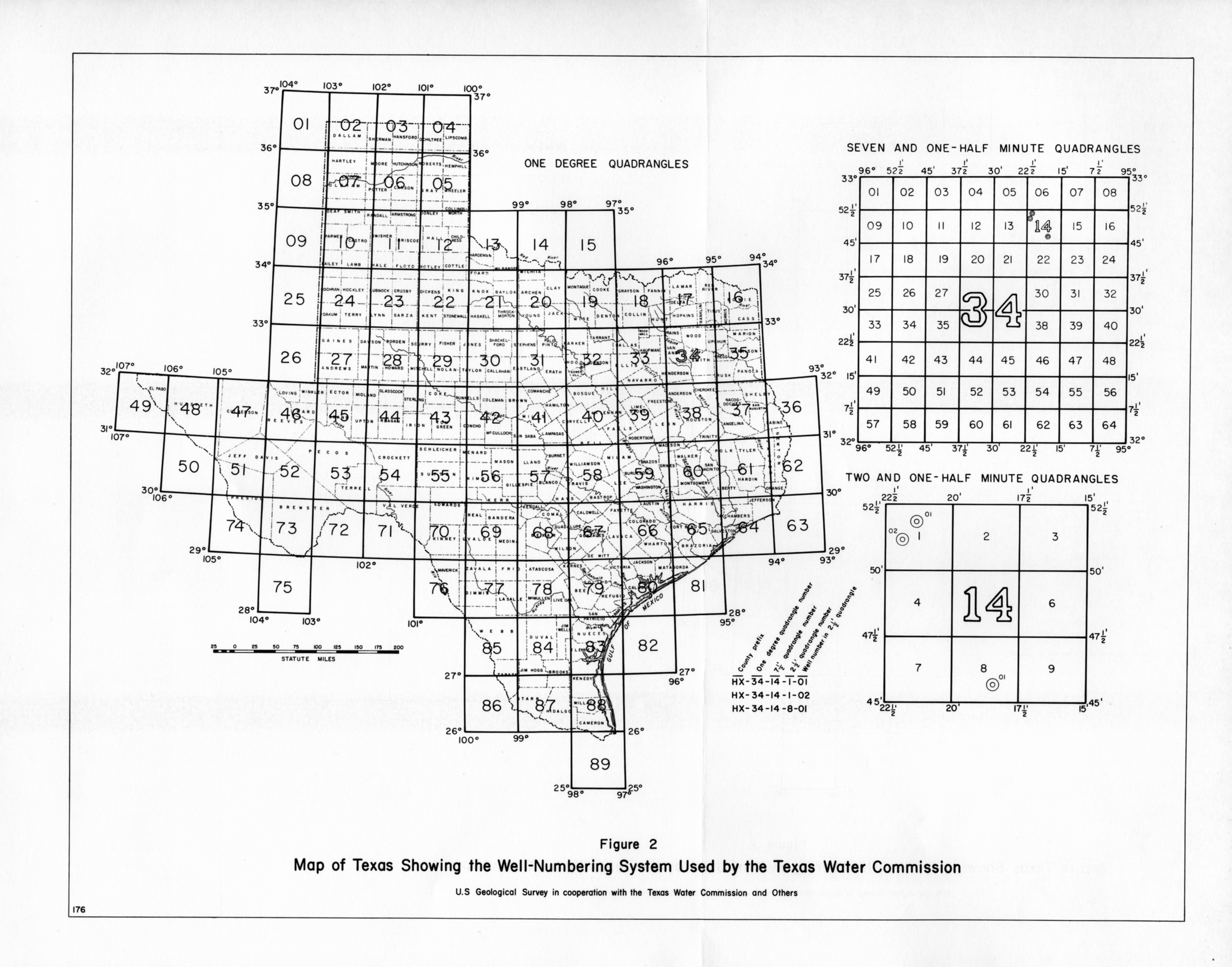
- Figure 2 Map of Texas Showing the Well-Numbering System Used by the Texas Water Commission
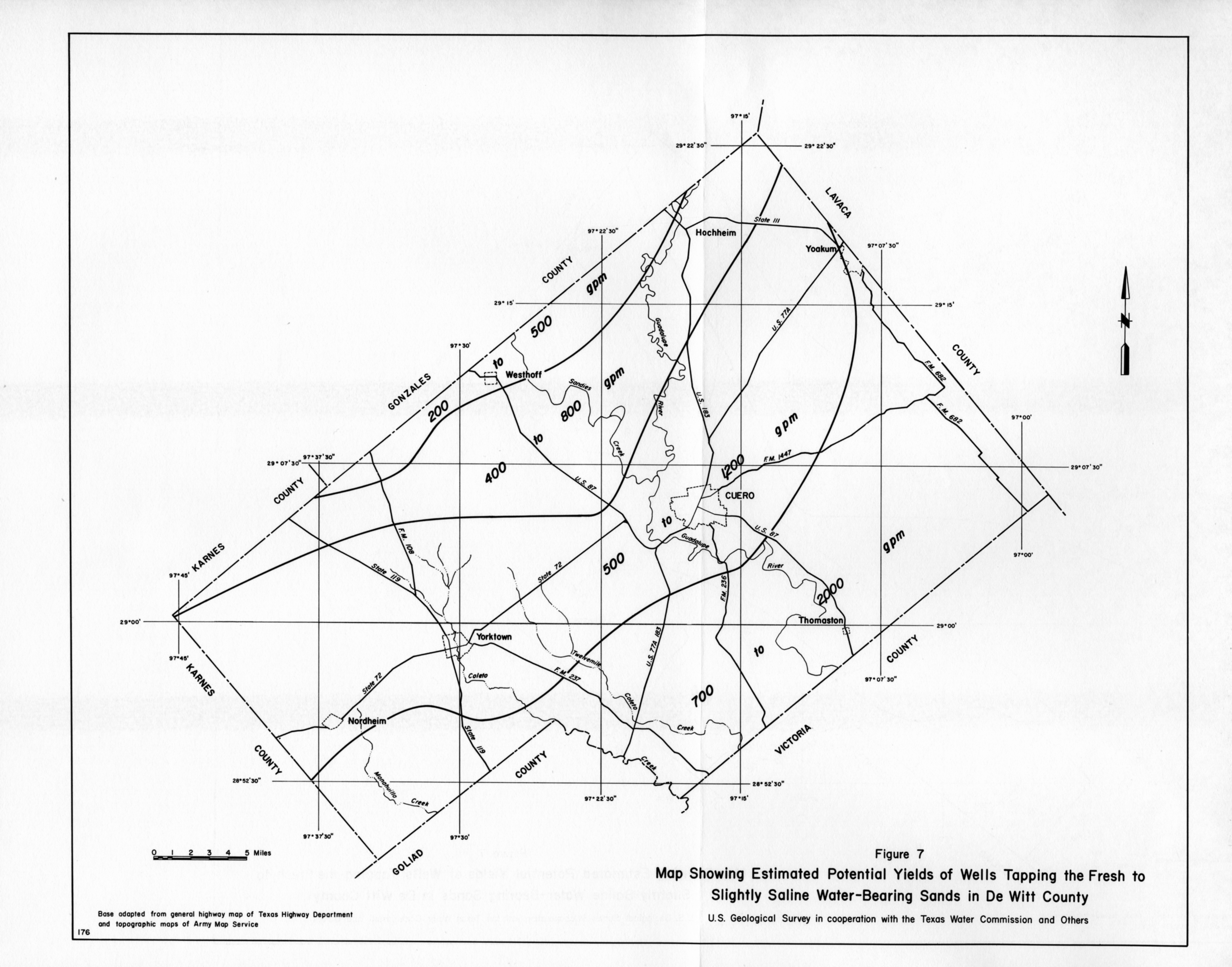
- Figure 7 Map Showing Estimated Potential Yields of Wells Tapping the Fresh top Slightly Saline Water-Bearing Sands in De Witt County
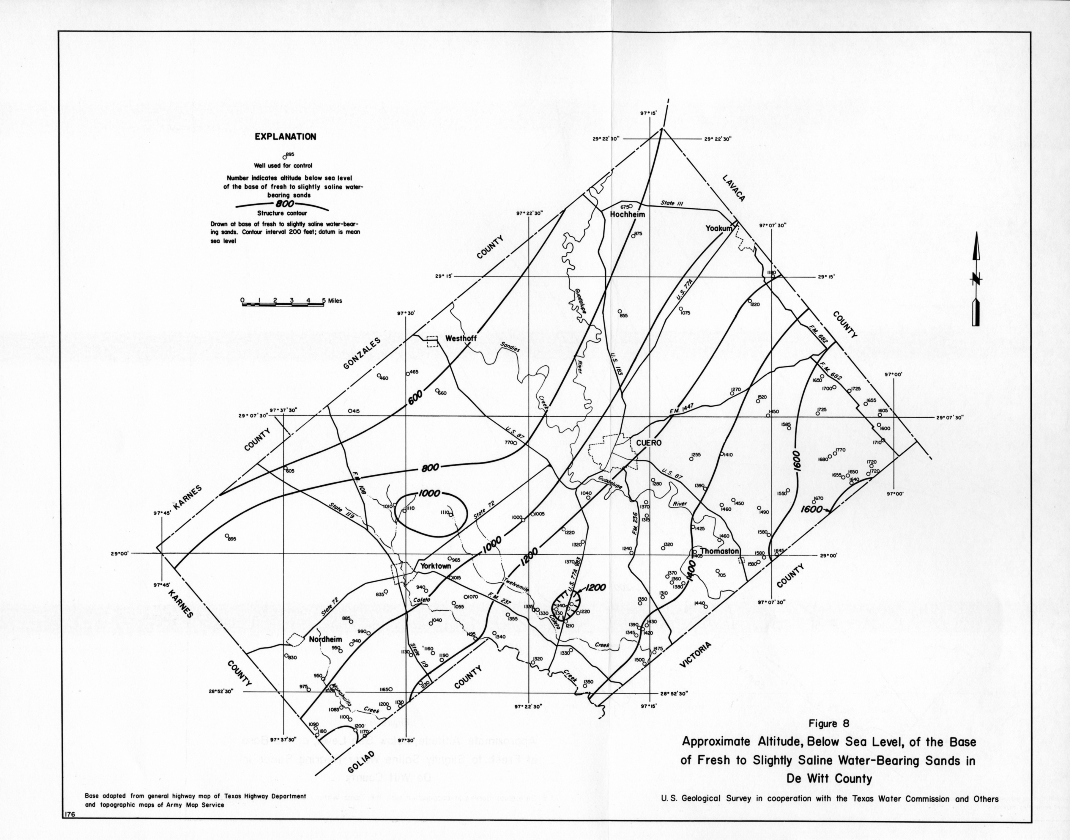
- Figure 8 Approximate Altitude, Below Sea Level, of the Base of Fresh to Slightly Saline Water-Bearing Sands in De Witt County
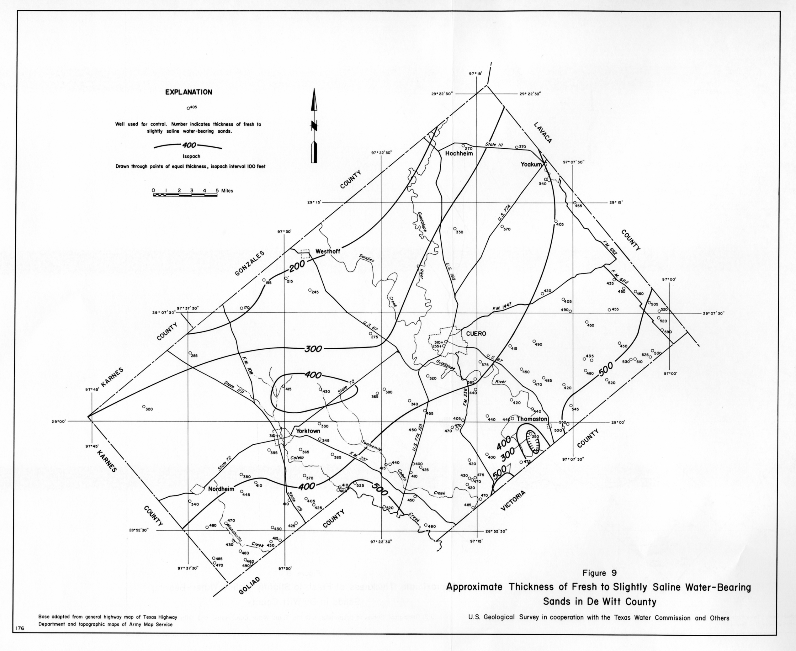
- Figure 9 Approximate Thickness of Fresh to Slightly Saline Water-Bearing Sands in De Witt County
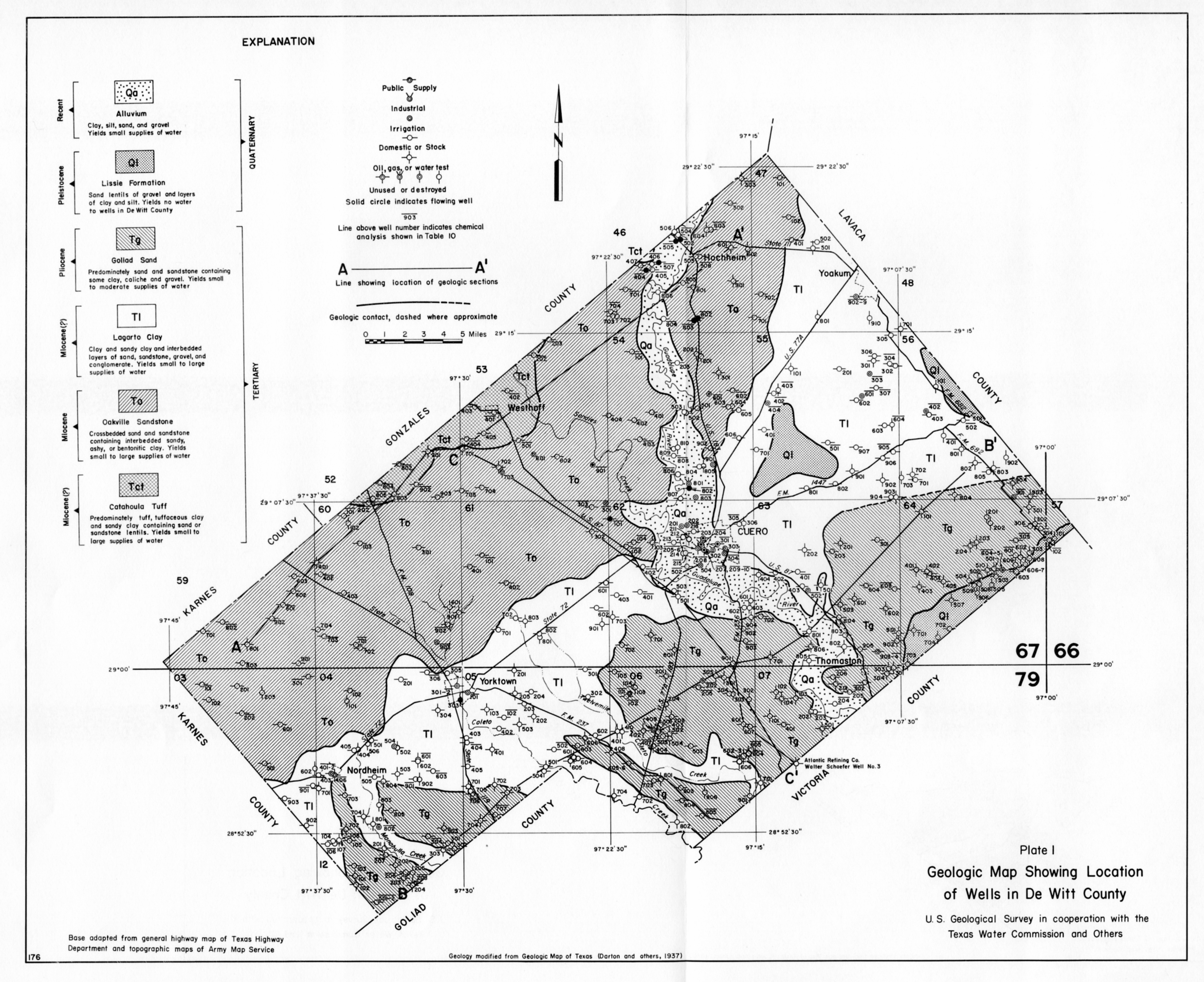
- Plate 1 Geologic Map Showing Location of Wells in De Witt County
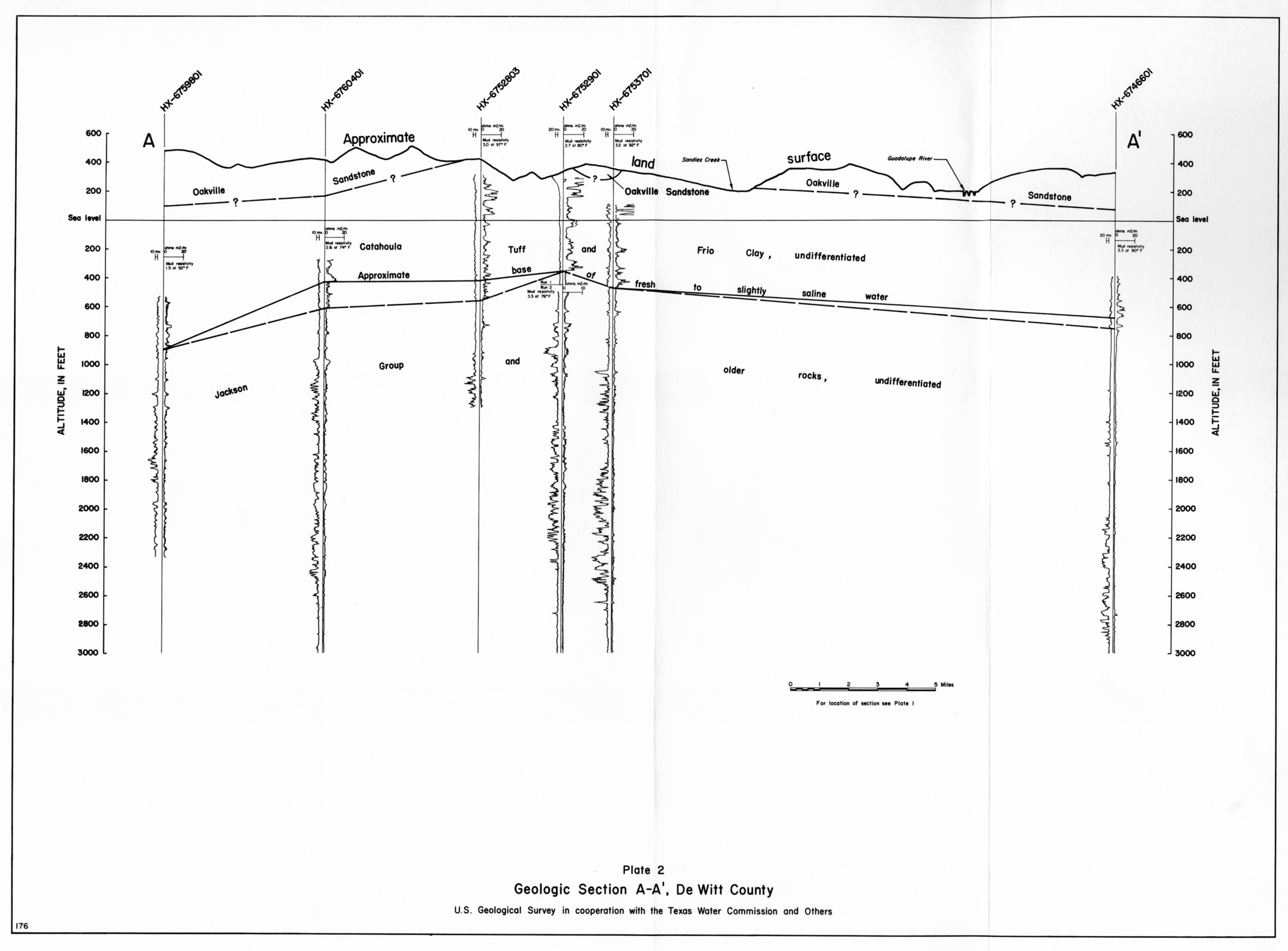
- Plate 2 Geologic Section A-A', De Witt County
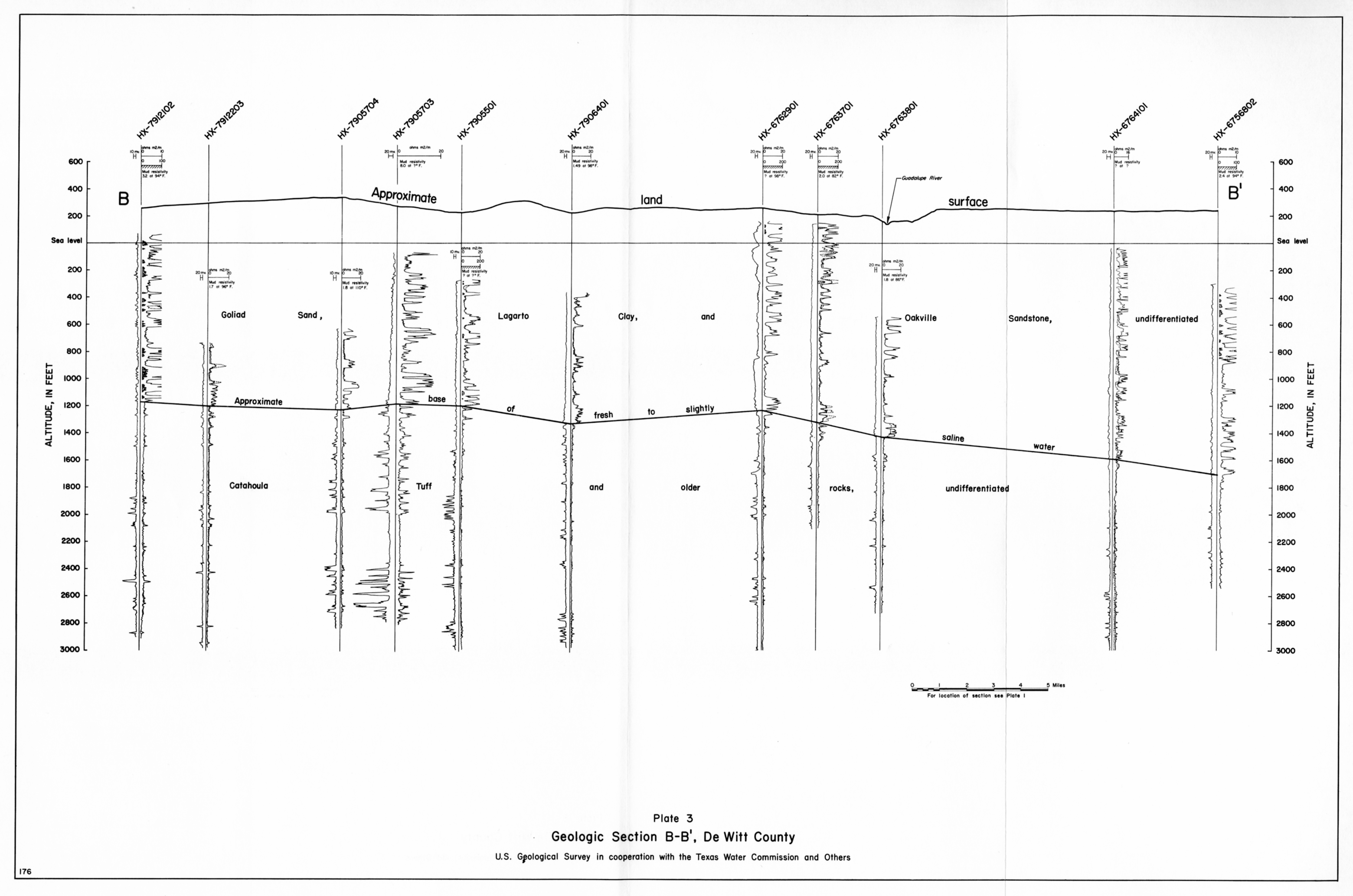
- Plate 3 Geologic Section B-B', De Witt County
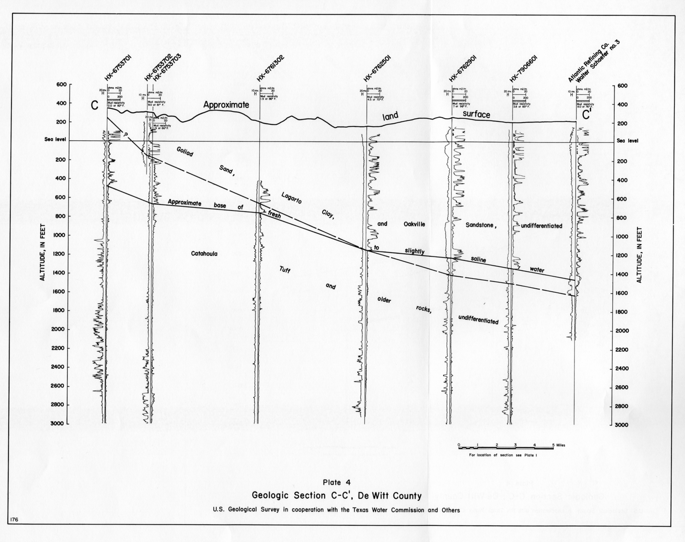
- Plate 4 Geologic Section C-C', De Witt County