Bulletin 6310 by J. G. Cronin and C.R. Follett, Hydraulic Engineers; G. H. Shafer and P.L. Rettman, Engineering Technicians United States Geological Survey
- Bulletin 6310 - Reconnaissance Investigation of the Ground-Water Resources of the Brazos River Basin, Texas (pdf - 35MB)
- Figure 1 (pdf - 3.86MB) - Map of the Brazos River Basin
- Figure 2 (pdf - 4.69MB) - Map of Texas Showing Well Numbering System
- Figure 6 (pdf - 765KB) - Section A-A' Region I
- Figure 7 (pdf - 2.05MB) - Section B-B' Region II
- Figure 8 (pdf - 2.82MB) - Section C-C' Region III
- Figure 9 (pdf - 3.27MB) - Section D-D' Region IV
- Table 1 (pdf - 4.43MB) - Geologic Units and their water-bearing properties
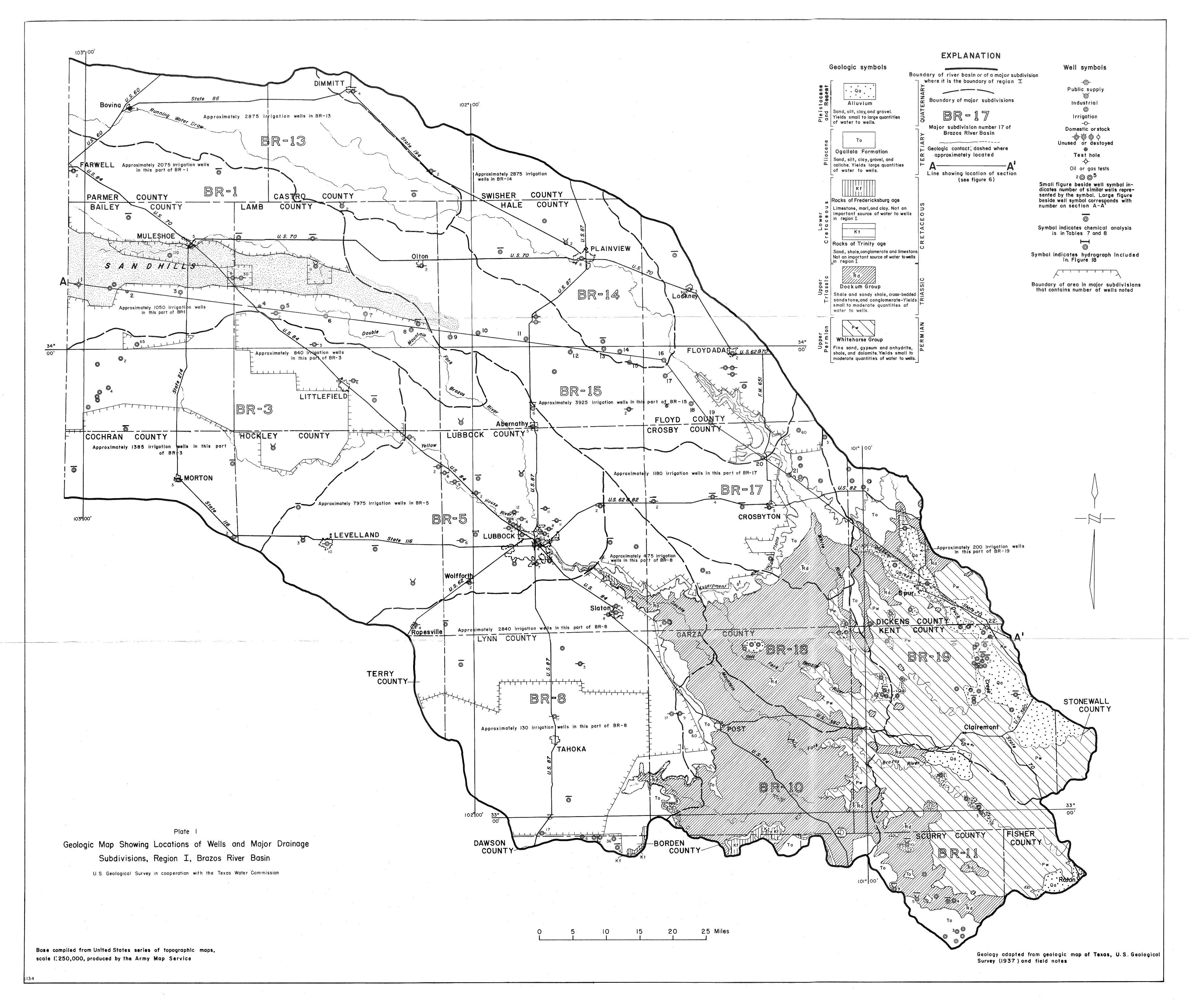
- Plate 1 (jpg - 4.1MB) Geologic Map Showing Locations of Wells and Major Drainage Subdivisions, Region I, Brazos River Basin
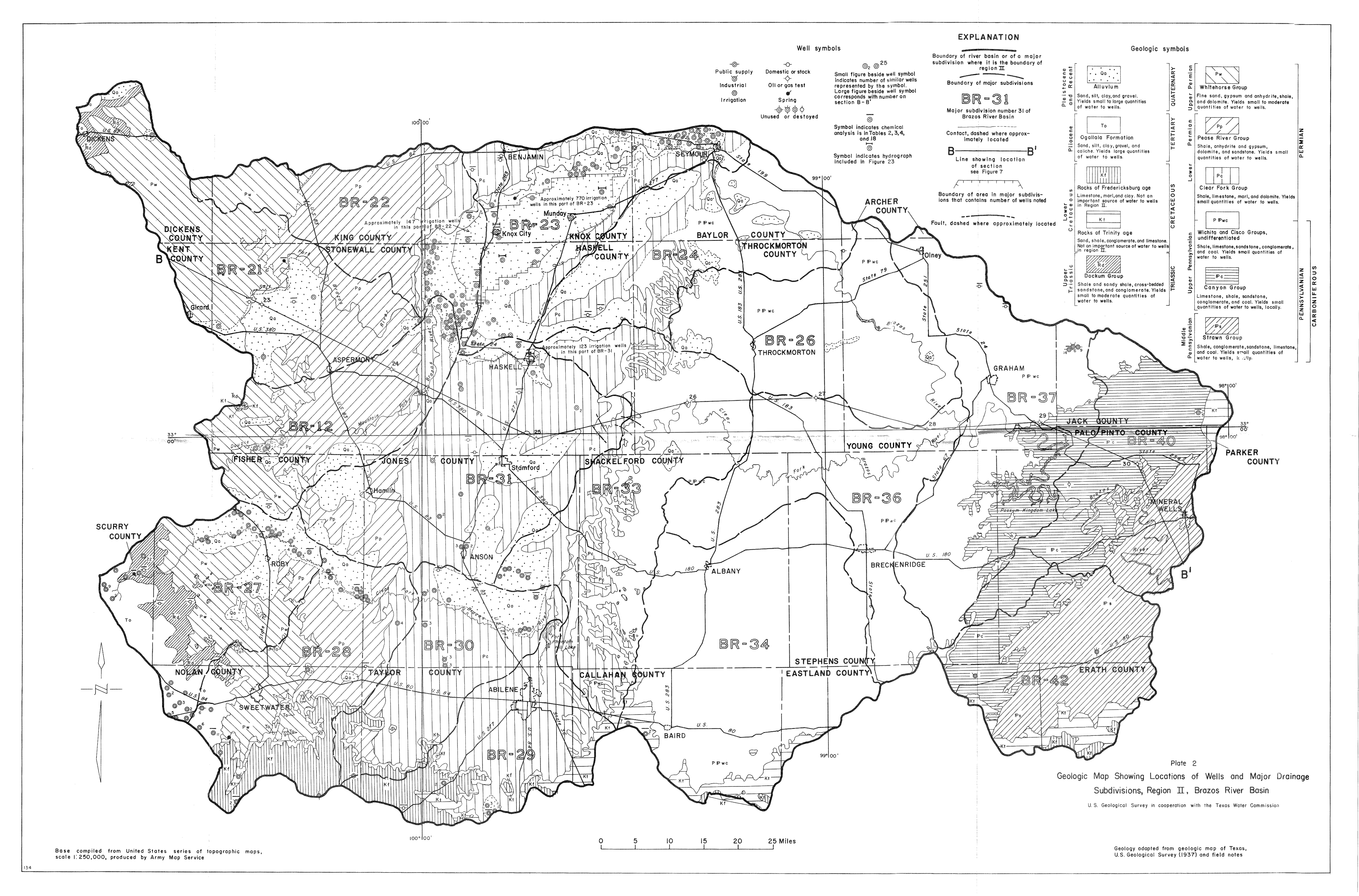
- Plate 2 (jpg - 5MB) Geologic Map Showing Locations of Wells and Major Drainage Subdivisions, Region II, Brazos River Basin
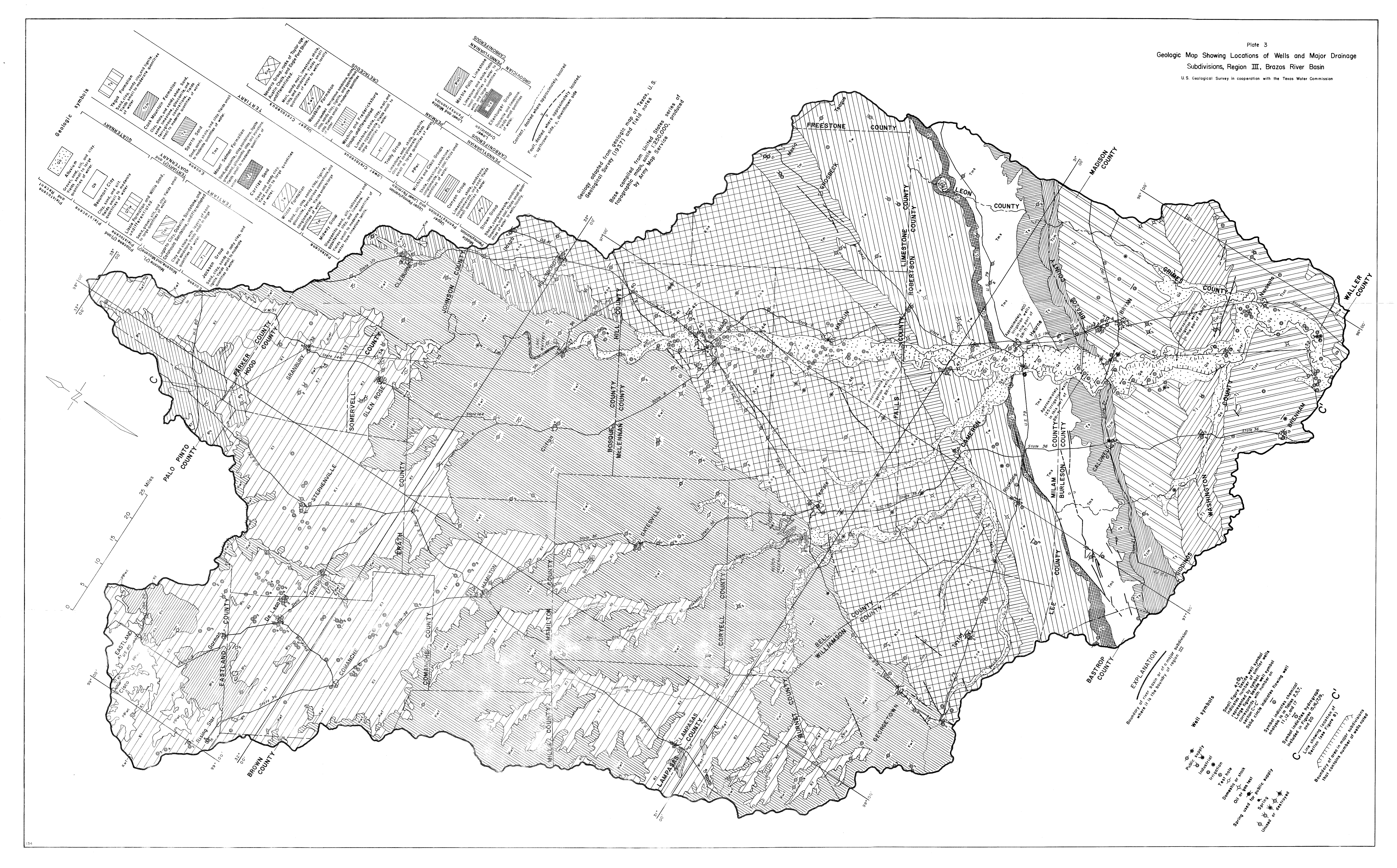
- Plate 3 (jpg - 11.6MB) Geologic Map Showing Locations of Wells and Major Drainage Subdivisions, Region III, Brazos River Basin
- Plate 4 (jpg - 1.4MB) Geologic Map Showing Locations of Wells and Major Drainage Subdivisions, Region IV, Brazos River Basin
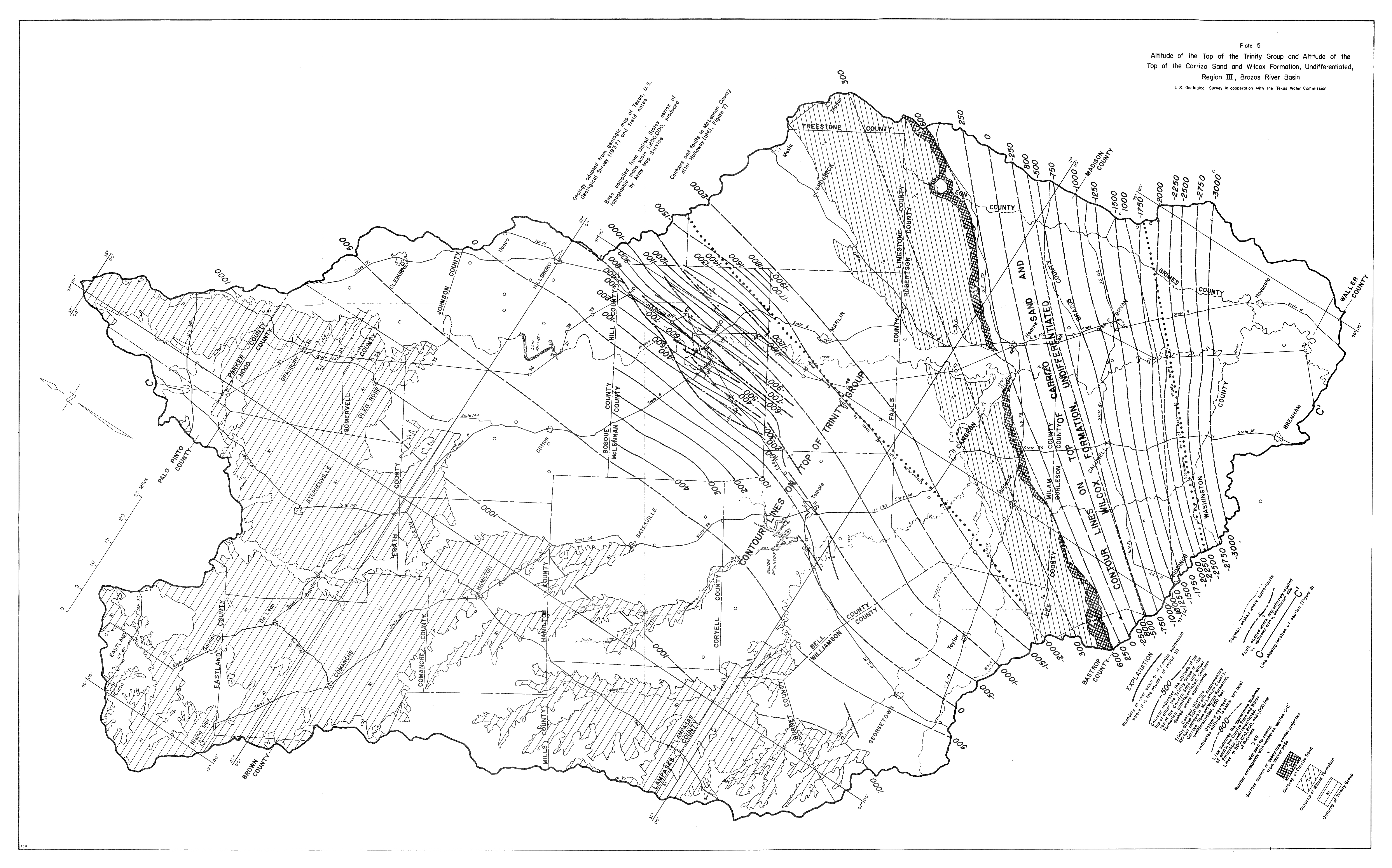
- Plate 5 (jpg - 6.4MB) Altitude of the Top of the Trinity Group and Altitude of the Too of the Carrizo Sand and Wilcox Formation, Undifferentiated, Region III, Brazos River Basin
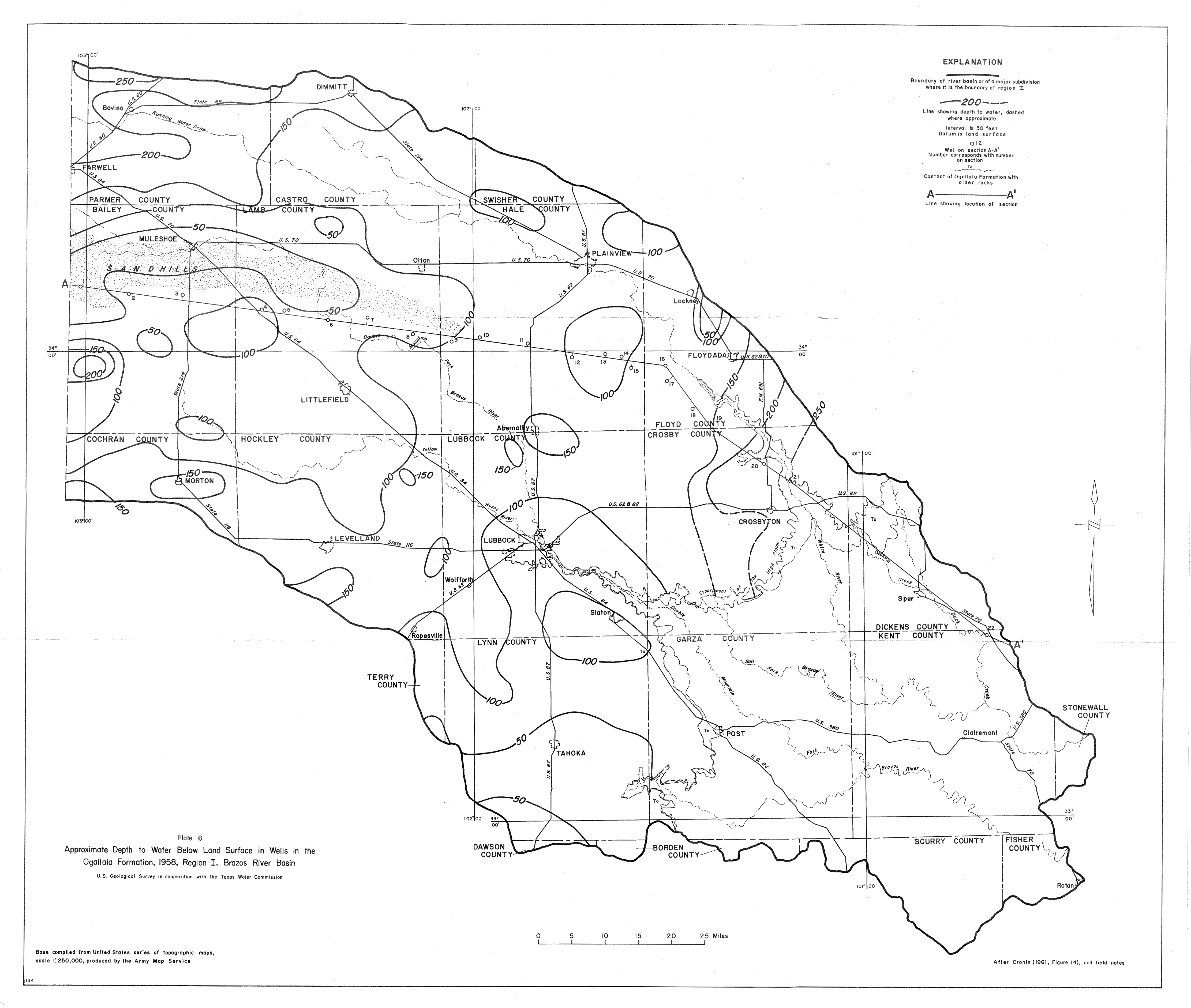
- Plate 6 (jpg - 2.6MB) Approximate Depth to Water Below Land Surface in Wells in the Ogallala Formation, 1958, Region I, Brazos River Basin
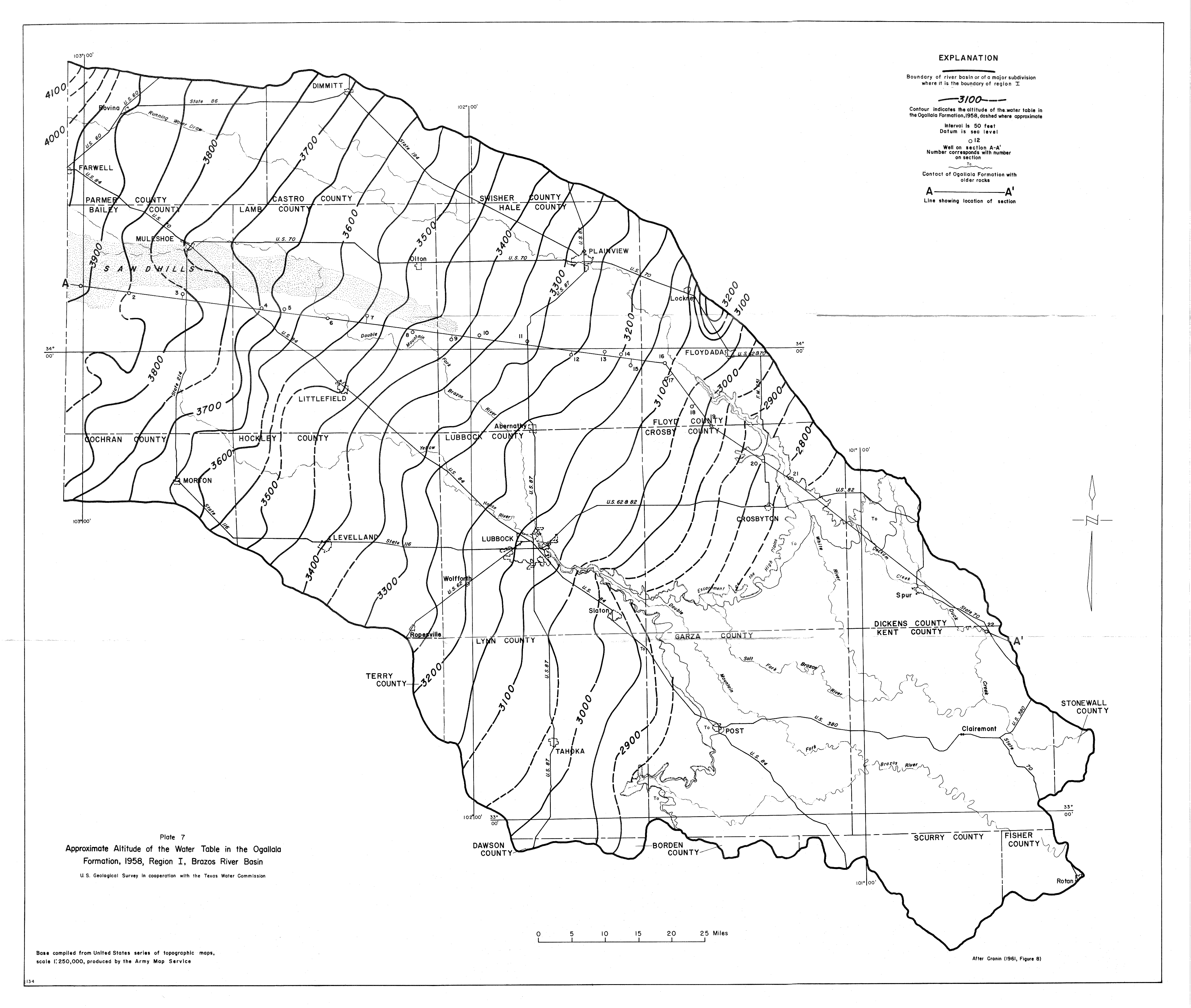
- Plate 7 (jpg - 2.9MB) Approximate Altitude of the Water Table in the Ogallala Formation, 1958, Region I, Brazos River Basin
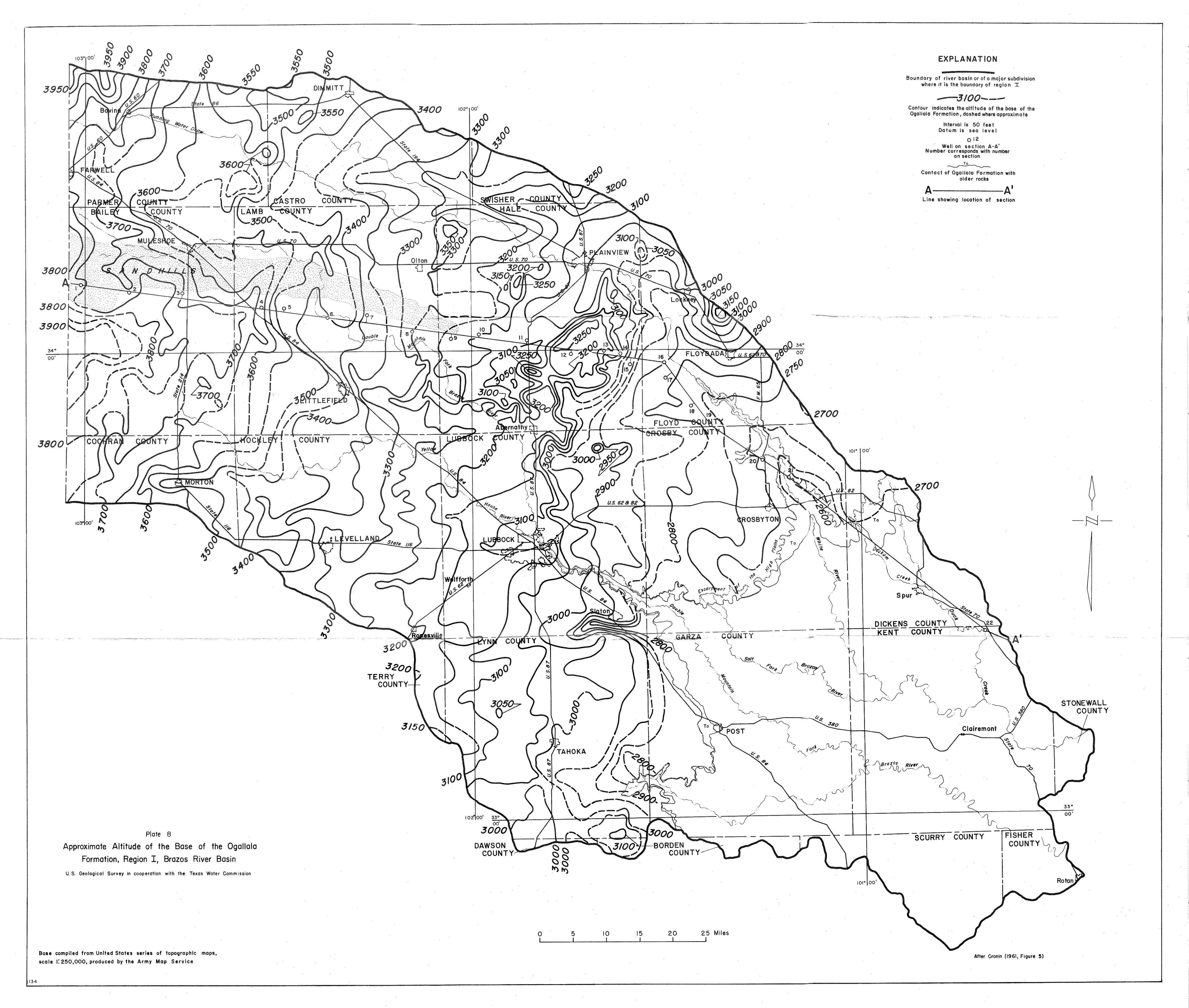
- Plate 8 (jpg - 3.6MB) Approximate Altitude of the Base of the Ogallala Formation, Region I, Brazos River Basin
- Plate 9 (jpg - 3.2MB) Approximate Saturated Thickness of the Ogallala Formation, 1958, Region I, Brazos River Basin
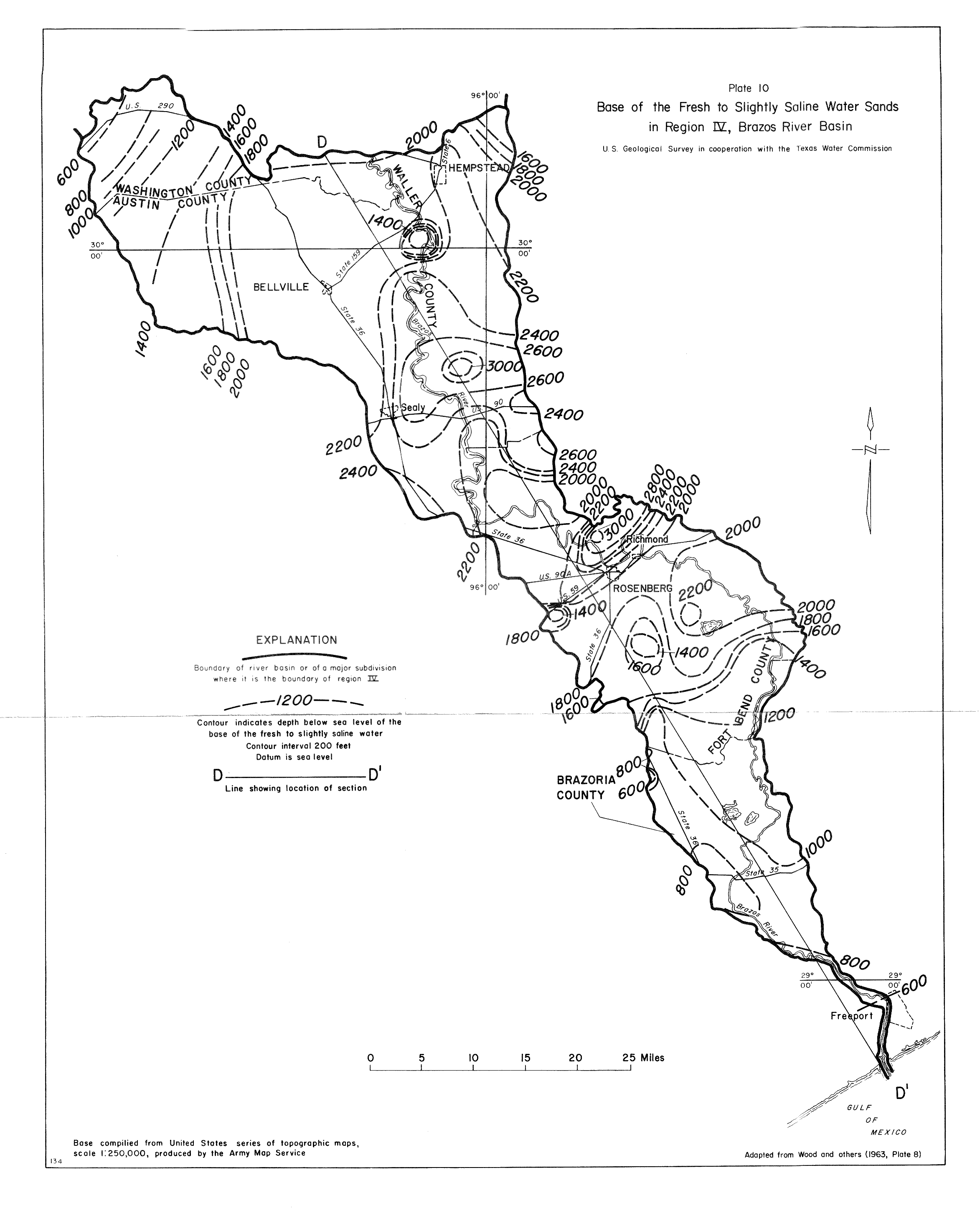
- Plate 10 (jpg - 1.1MB) Base of the Fresh to Slightly Saline Water Sands in Region IV, Brazos River Basin
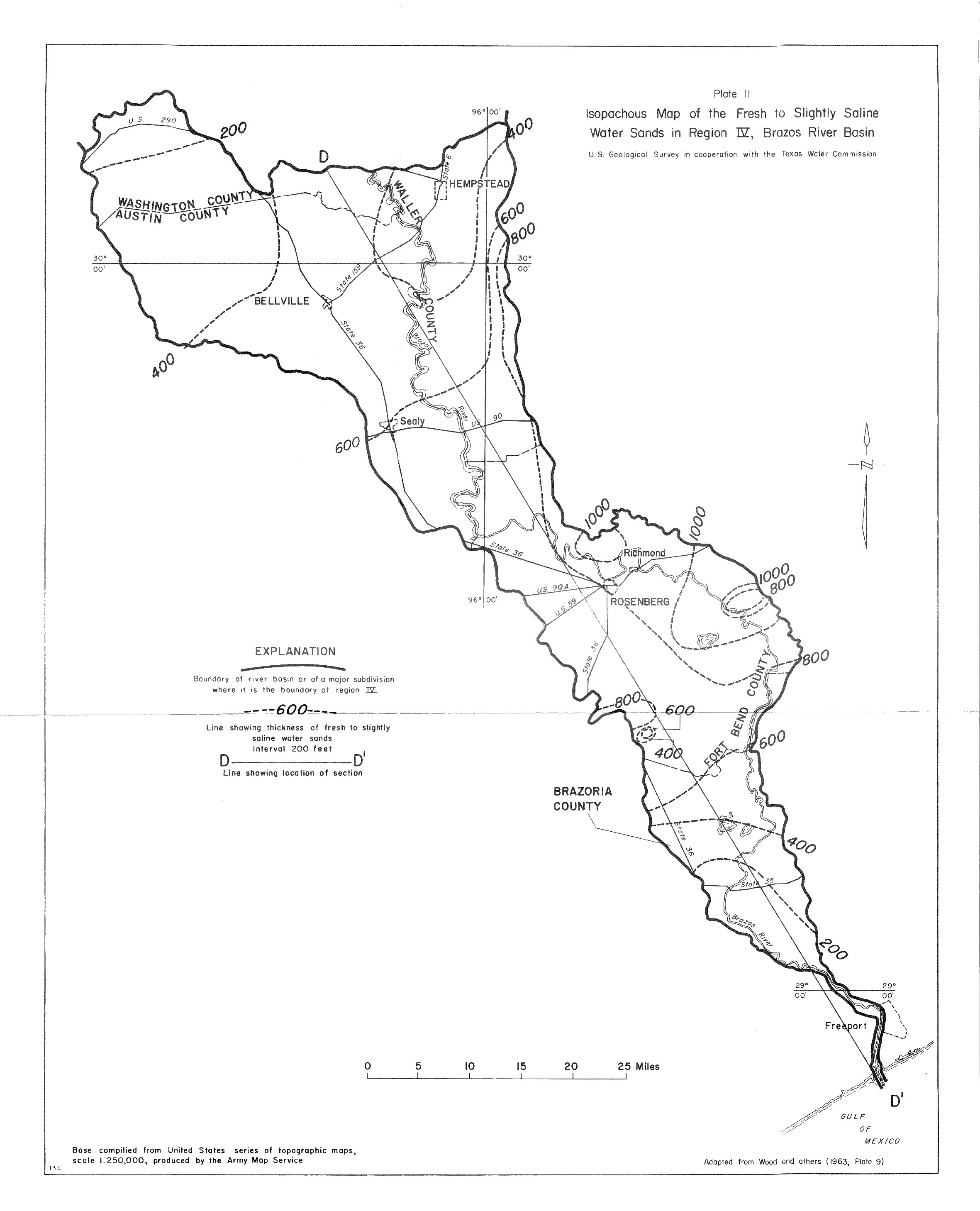
- Plate 11 (jpg - 919 KB) Isopachous Map of the Fresh to Slightly Saline Water Sands in Region IV, Brazos River Basin