Bulletin 6014 volumes 1 and 2 by Roger C. Baker, Geologist and O. C. Dale, Engineering Technician, U.S. Geological Survey | February 1961
Records of Wells, Drillers' Logs, Water Level in Wells, and Chemical Analyses of Water
- Bulletin 6014, Volume I - Ground-Water Resources of the Lower Rio Grande Valley Area, Texas, Volume I (pdf - 7.4MB)
- Plate 2 (pdf - 1.45MB) - Geologic section A-A', Starr County, Texas
- Plate 3 (pdf - 1.23MB) - Geologic section B-B', Hidalgo County, Texas
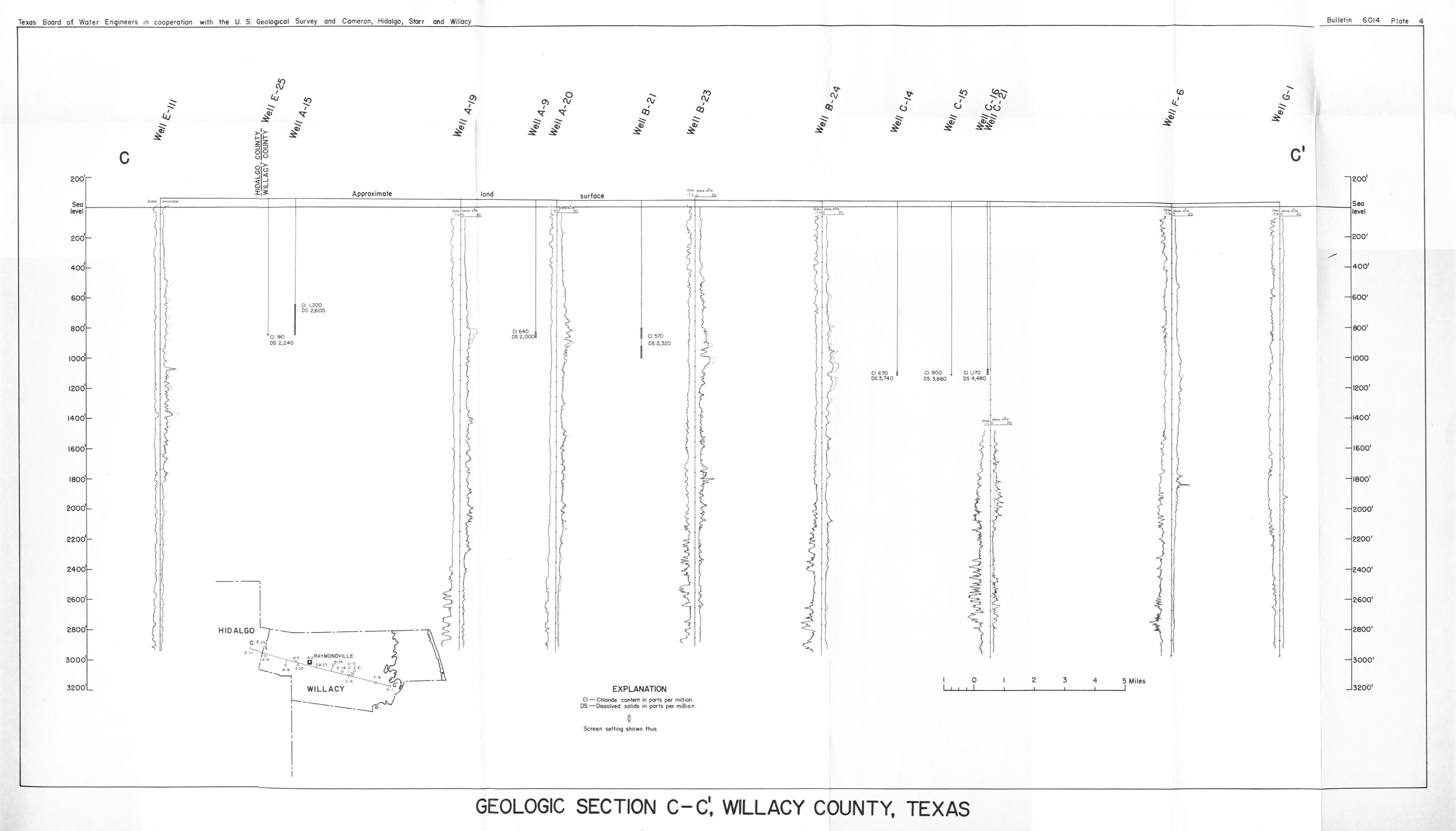
- Plate 4 (jpg - 391 KB) - Geologic section C-C', Willacy County, Texas
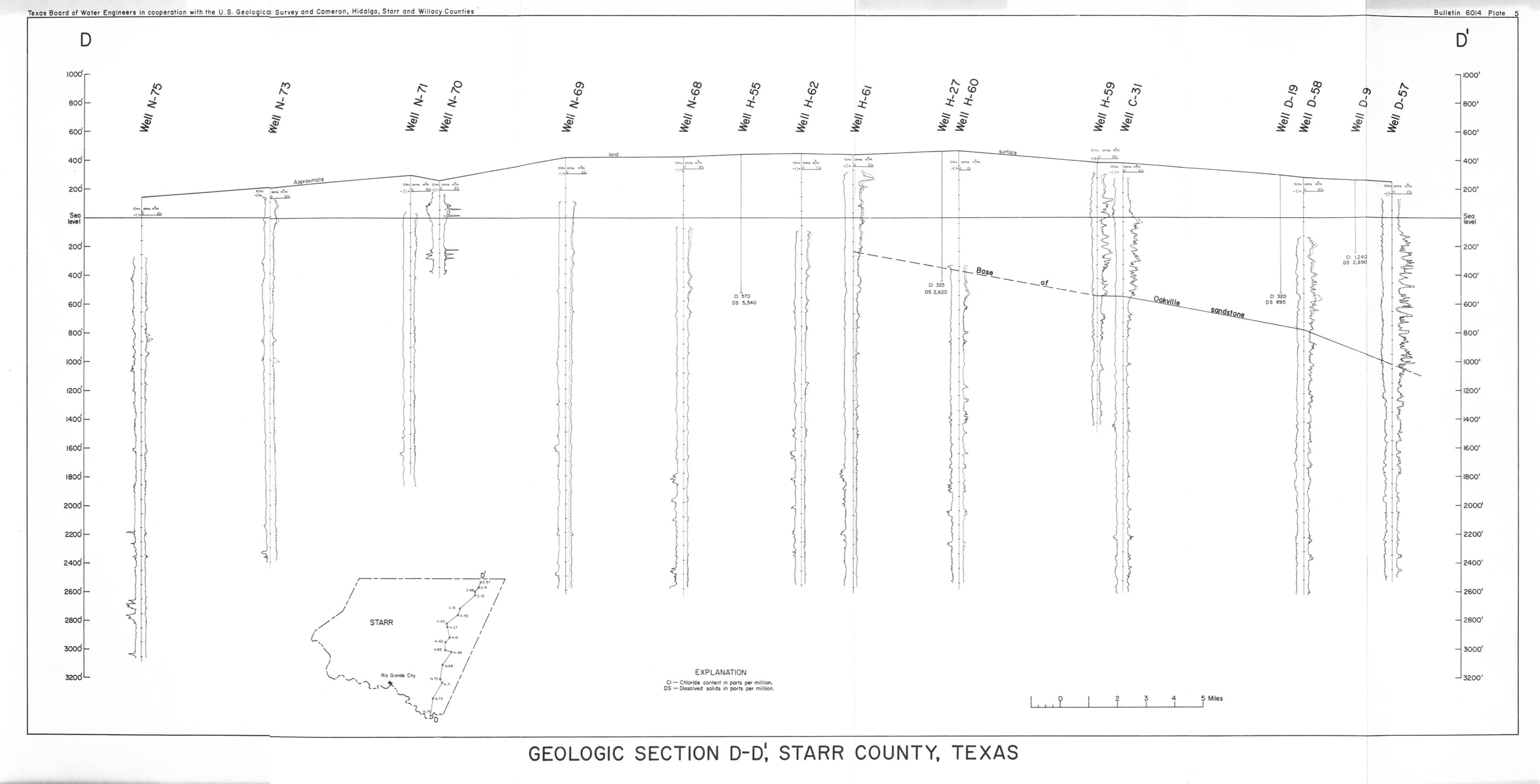
- Plate 5 (jpg - 308 KB) - Geologic section D-D', Starr County, Texas
- Figure 13 (pdf - 0.92MB) - Map showing approximate salinity hazard, sodium hazard, and boron content of water from selected wells believed to tap the Goliad sand in northern Hidalgo County and Willacy County, Texas
- Figure 14 (pdf - 1.03MB) - Map showing the chloride and dissolved-solids content of water from selected wells believed to tap the Goliad sand in northern Hidalgo, Willacy, and southern Kenedy Counties, Texas
- Bulletin 6014, Volume II - Ground-Water Resources of the Lower Rio Grande Valley Area, Texas (pdf - 42.8MB)
- Plate 1: Map showing location of wells in the lower Rio Grande Valley area (jpg 1.4 MB)
- Well Location Map a (pdf - 0.81MB)
- Well Location Map b (pdf - 1.25MB)
- Well Location Map c (pdf - 1.39MB)
- Well Location Map d (pdf - 1.23MB)