Bulletin 6307 By Bernard B. Baker, Joe w. Dillard, Vernon L. Souders, and Richard C. Peckham, Texas Water Commission | August 1963
Oversize fold out maps were scanned separately from the report above. "Missing pages" in the report are the maps below.
- Bulletin 6307 - Reconnaissance Investigation of the Ground-Water Resources of the Sabine River Basin, Texas
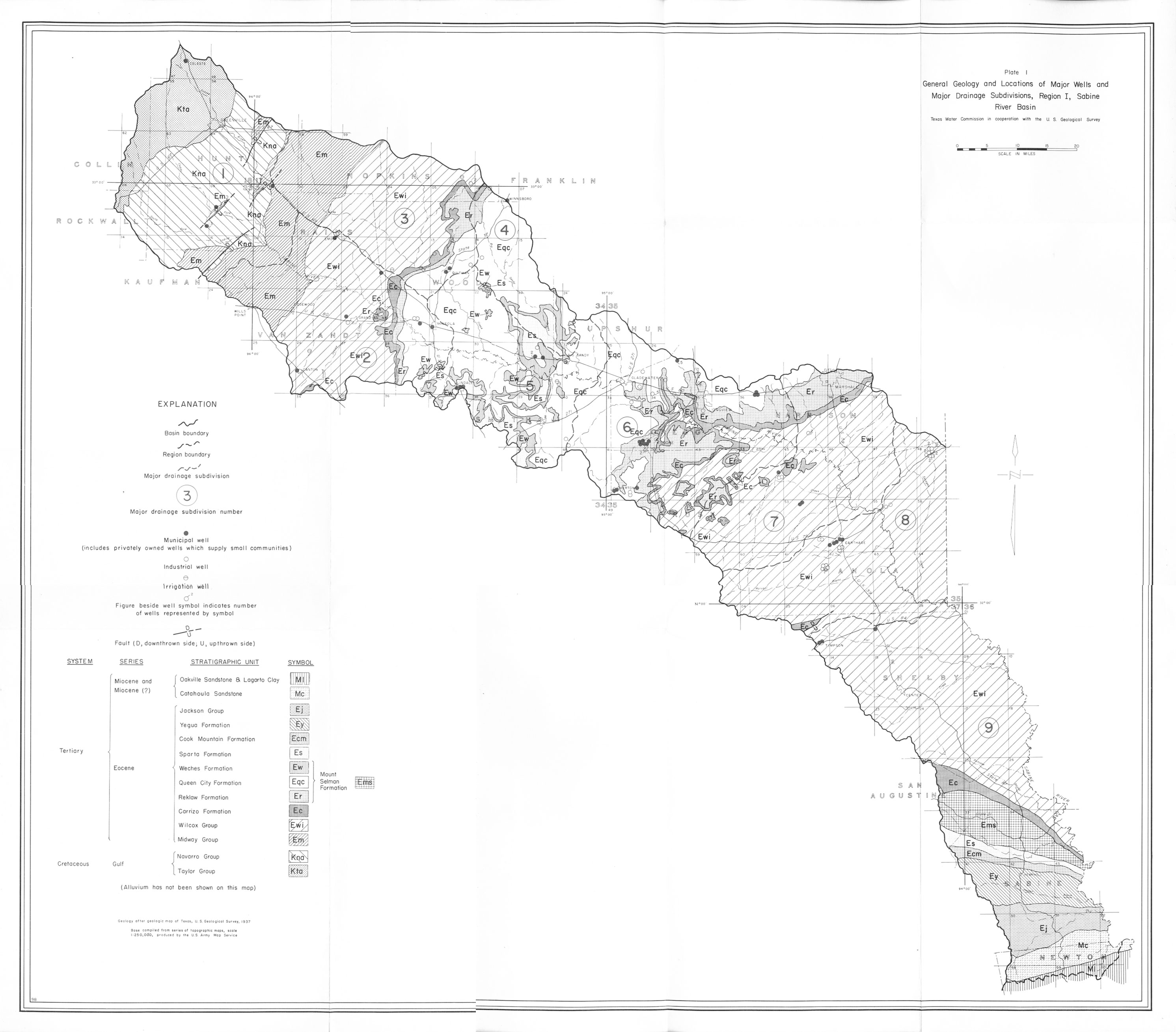
- Plate 1 General Geology and Locations of Major Wells and Major Drainage Subdivisions, Region 1, Sabine River Basin
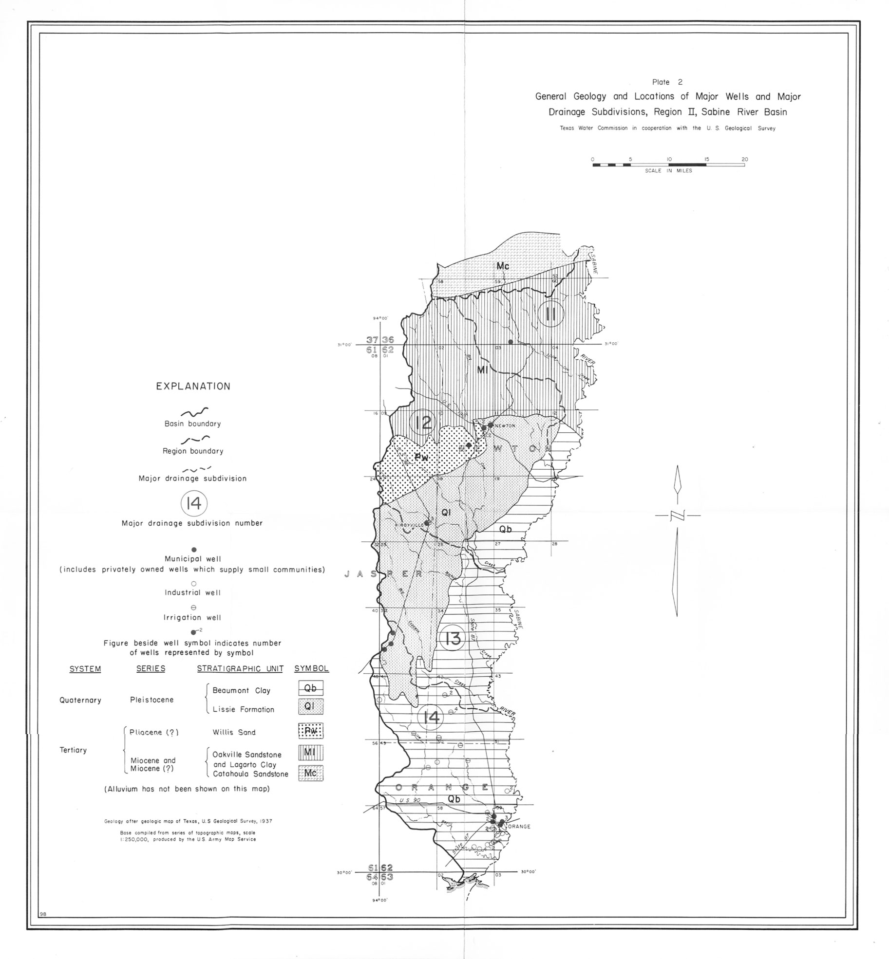
- Plate 2 General Geology and Locations of Major Wells and Major Drainage Subdivisions, Region 2, Sabine River Basin
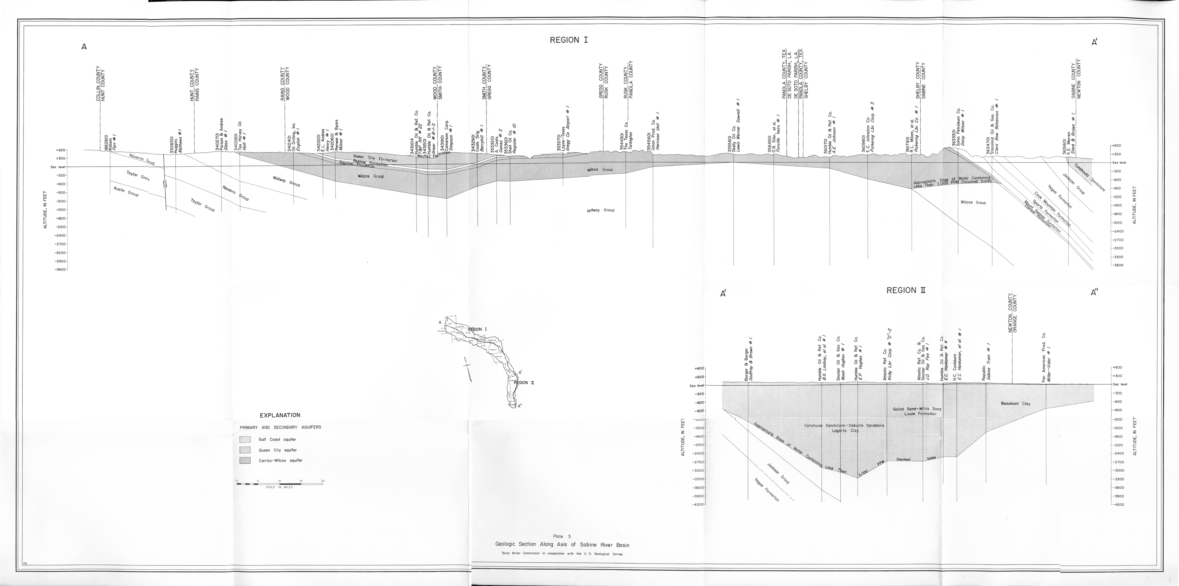
- Plate 3 Geologic Section Along Axis of Sabine River Basin
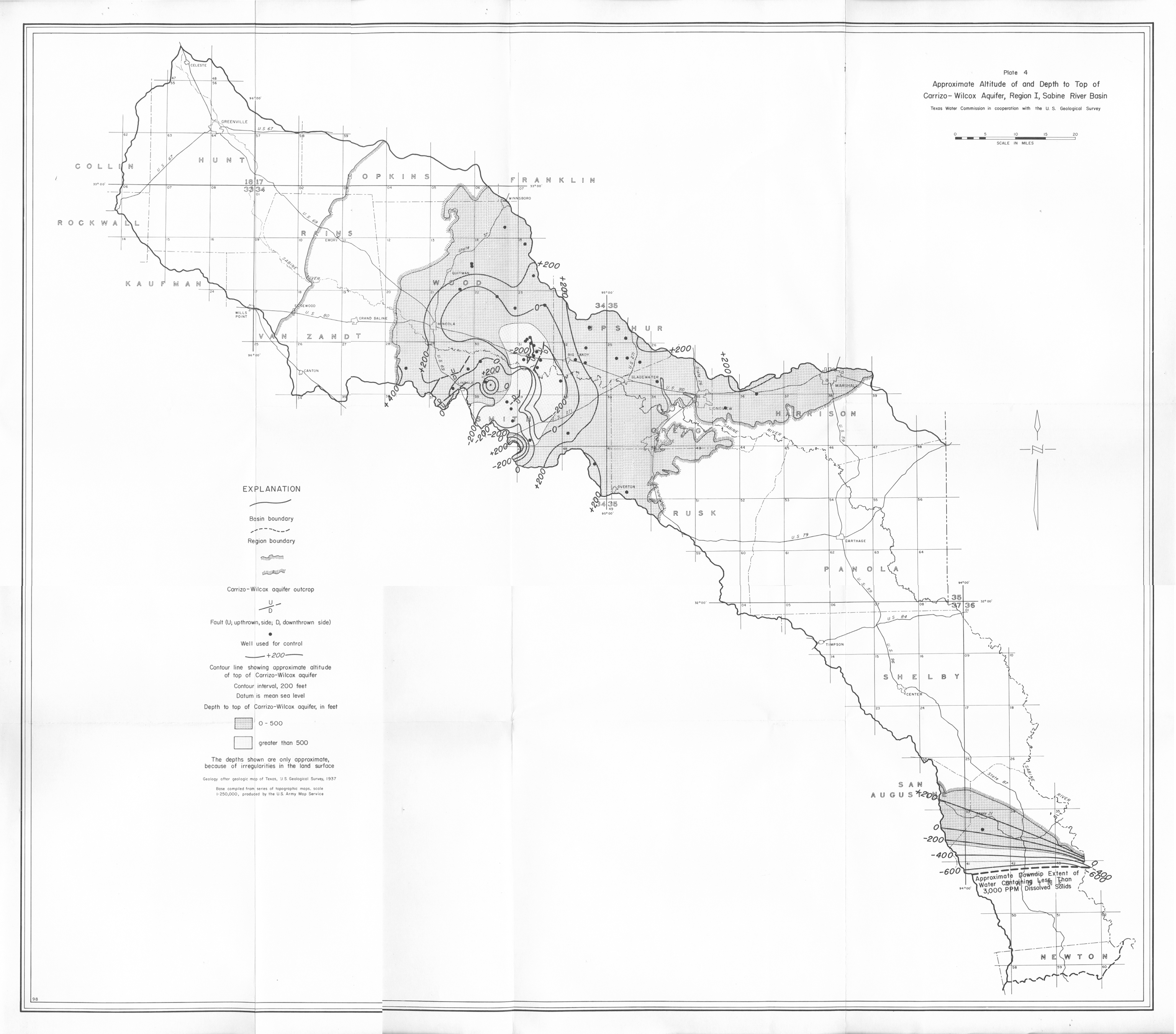
- Plate 4 Approximate Altitude of and Depth to Top of Carrizo-Wilcox Aquifer, Region 1, Sabine River Basin
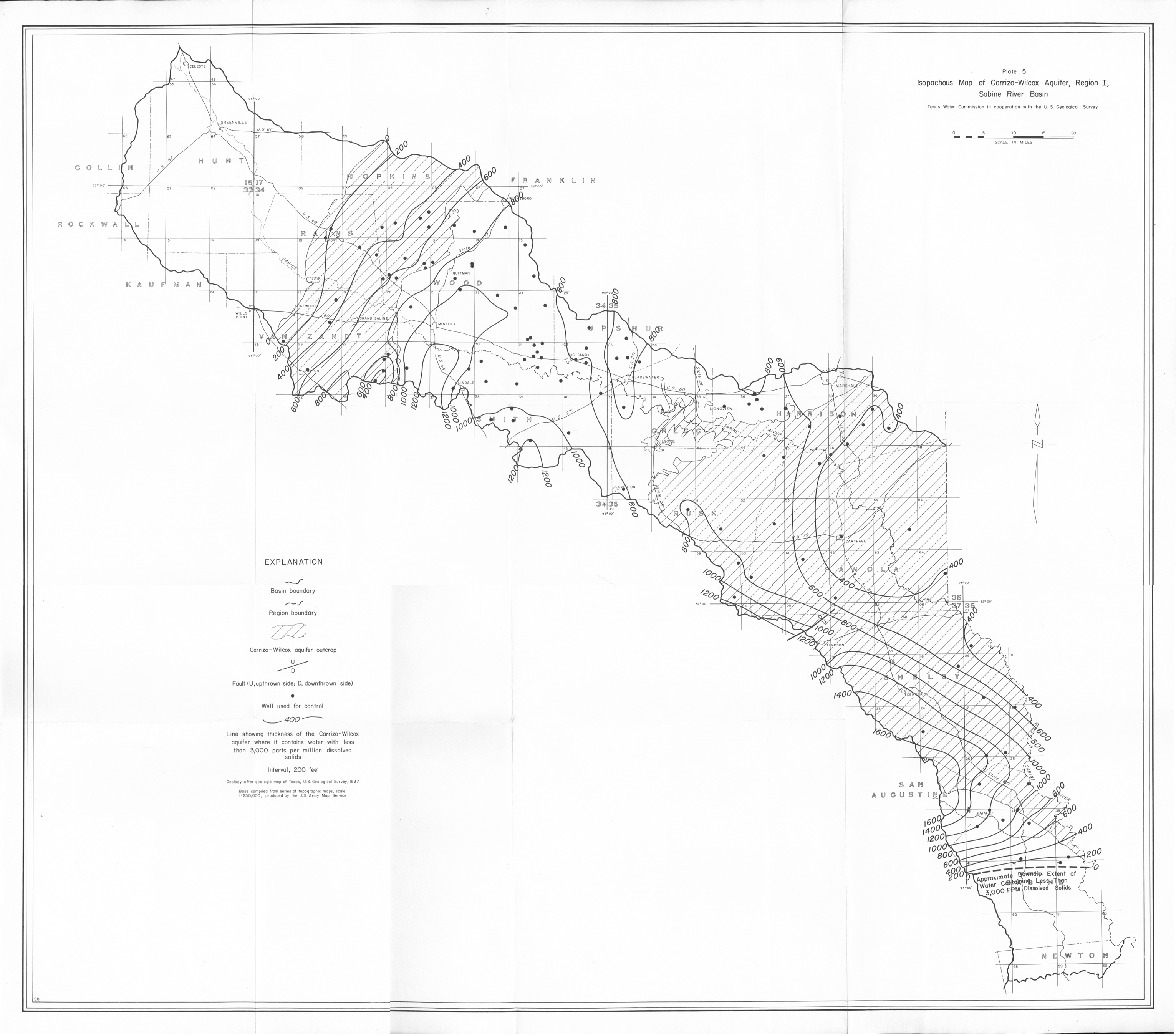
- Plate 5 Isopachous Map of the Carrizo-Wilcox Aquifer, Region 1, Sabine River Basin
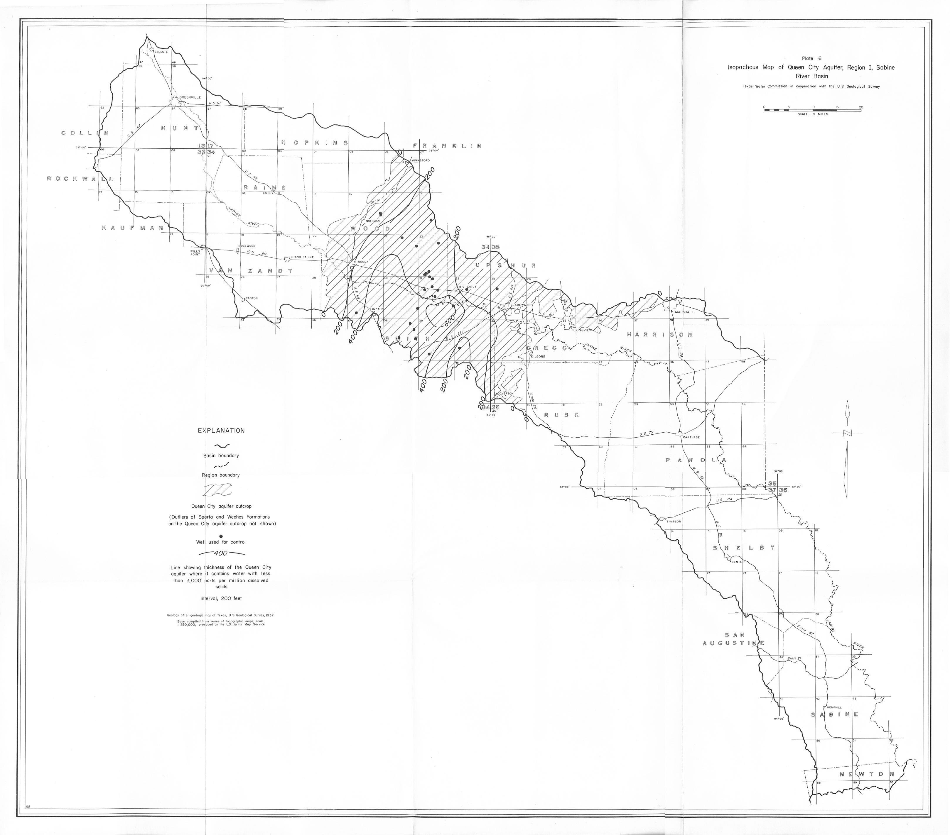
- Plate 6 Isopachous Map of the Queen City Aquifer, Region 1, Sabine River Basin
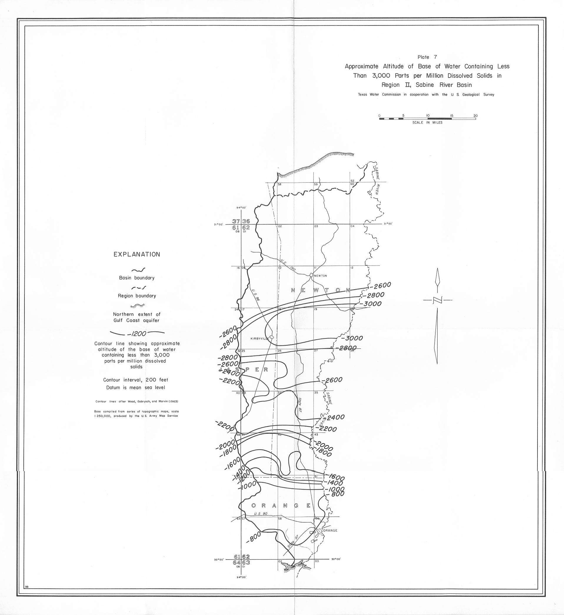
- Plate 7 Approximate Altitude of Base of Water Containing Less Than 3,000 Parts per Million Dissolved Solids in Region 2, Sabine River Basin
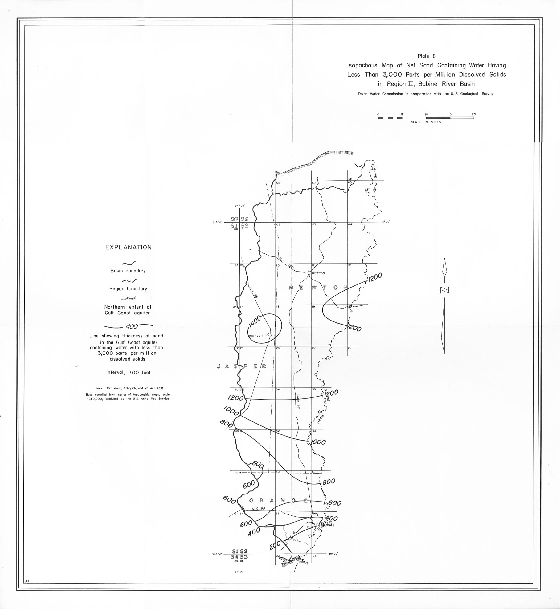
- Plate 8 Isopachous Map of Net Sand Containing Water Having Less Than 3,000 Parts per Million Dissolved Solids in Region 2, Sabine River Basin