Bulletin 6107 By J.G. Cronin, U.S. Geological Survey | September 1961 (second printing October 1971)
Oversize fold out maps were scanned separately from the report above. "Missing pages" in the report are the maps below.
- Bulletin 6107 - A Summary of the Occurrence and Development of Ground Water in the Southern High Plains of Texas
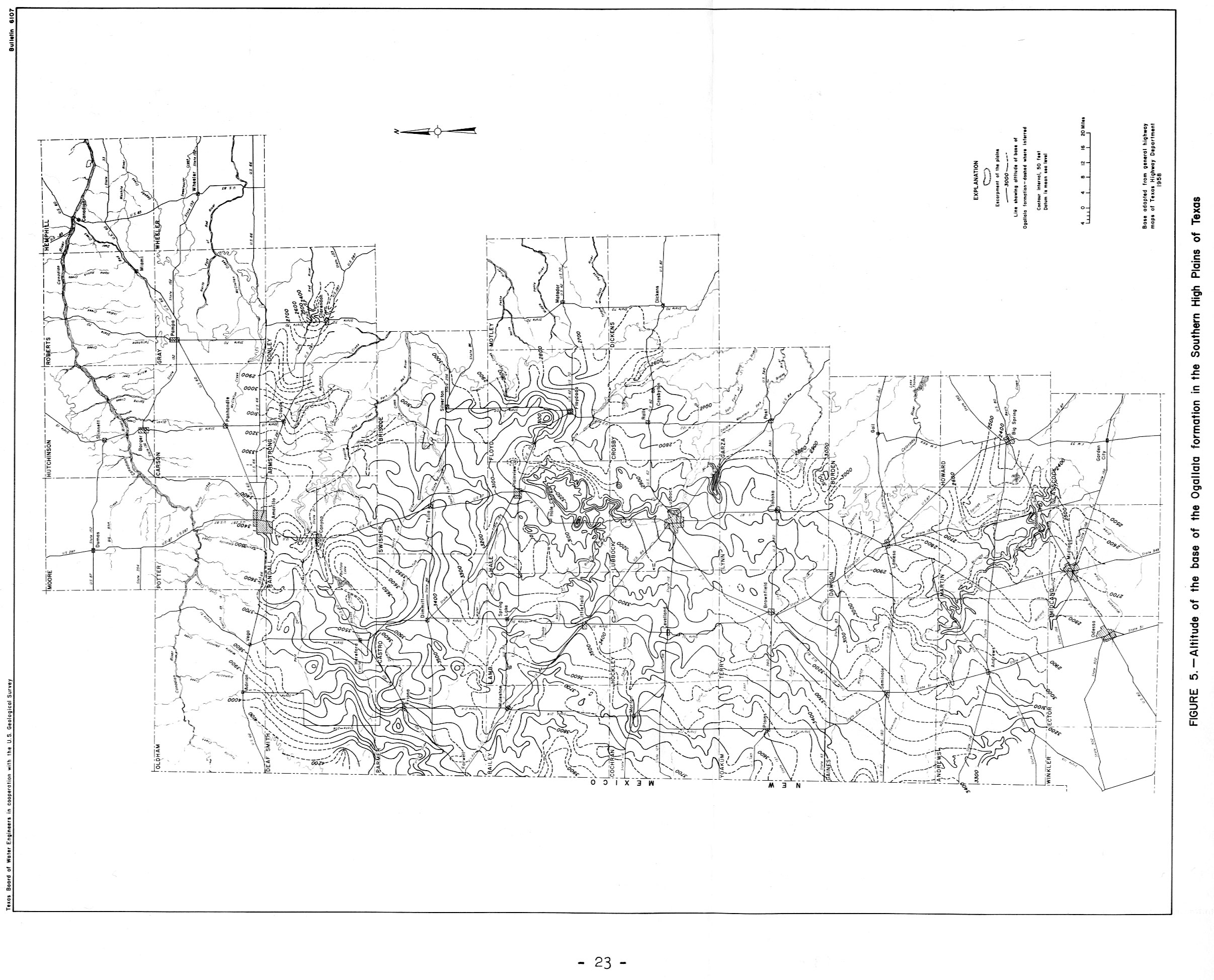
- Page 23 Figure 5 Altitude of the base of the Ogallala formation in the Southern High Plains of Texas
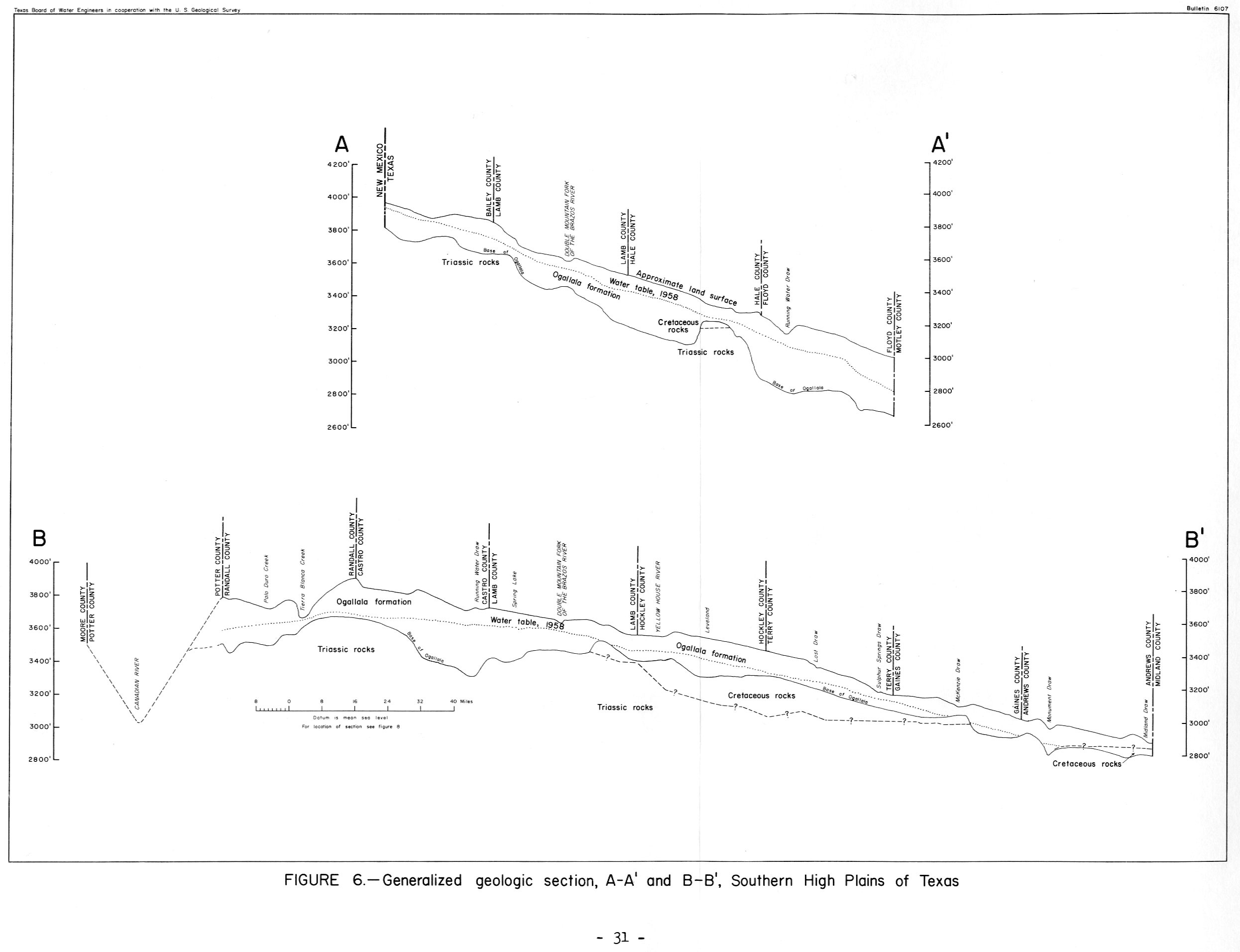
- Page 31 Figure 6 Generalized geologic section, A-A' and B-B,' Southern High Plains of Texas
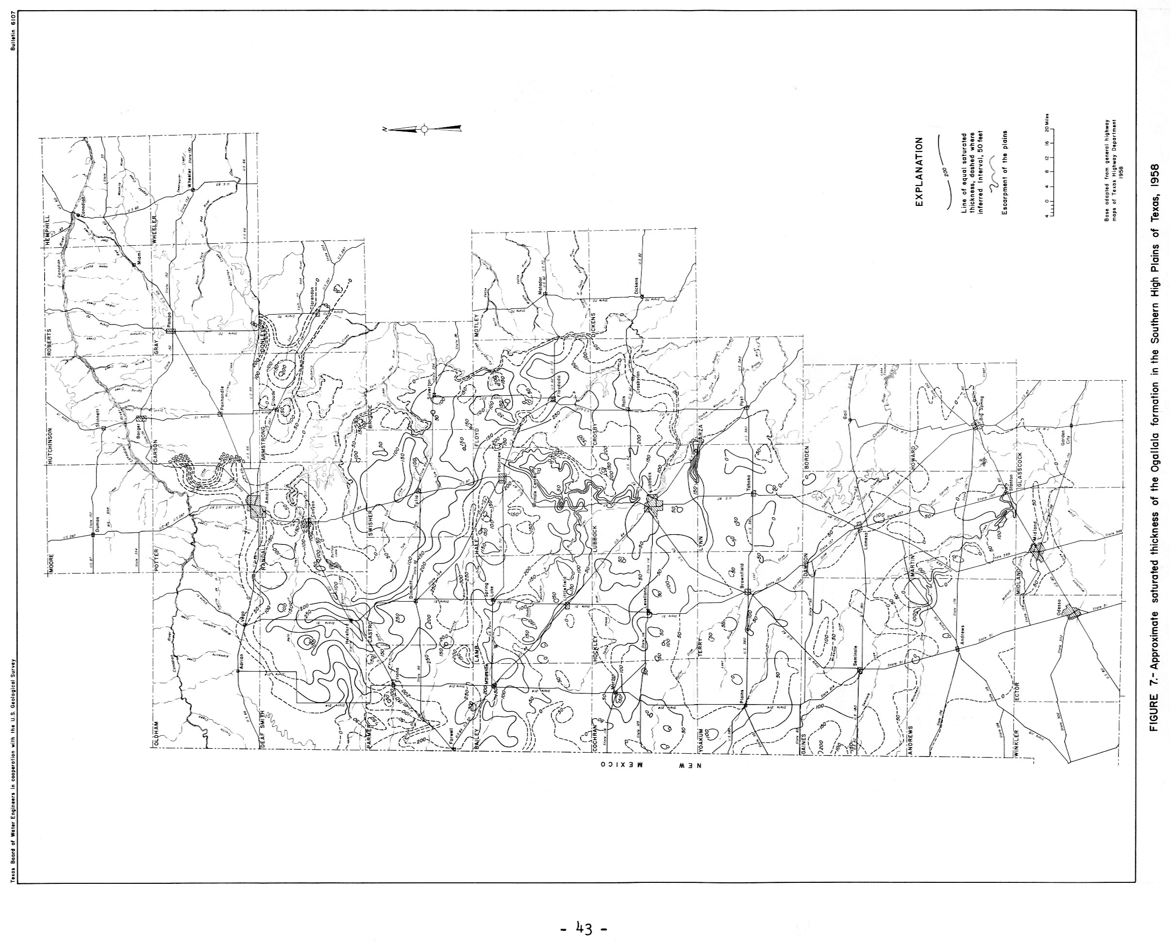
- Page 43 Figure 7 Approximate Altitude and Thickness of the Ogallala formation in the Southern High Plains of Texas, 1958
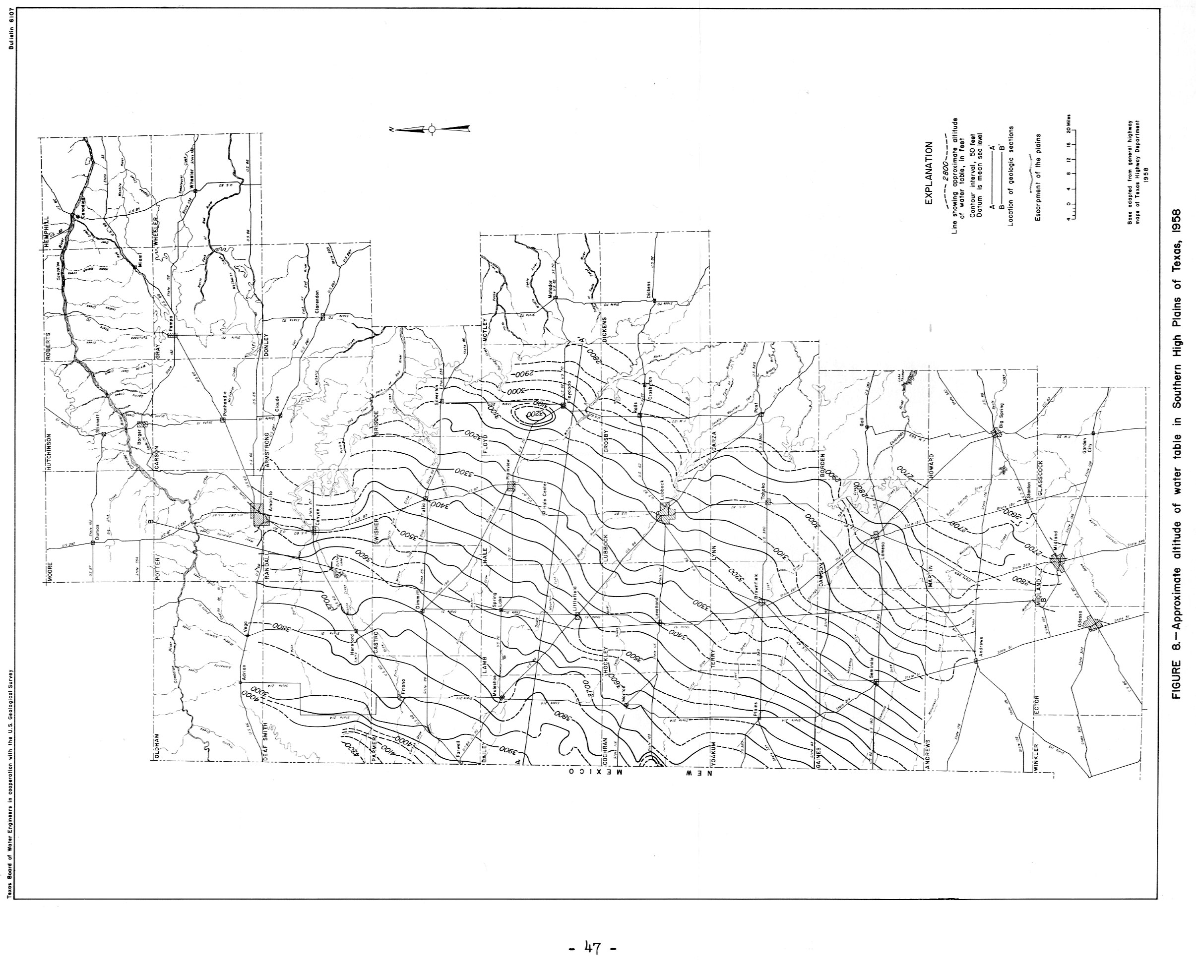
- Page 47 Figure 8 Approximate Altitude of water table in the Southern High Plains of Texas
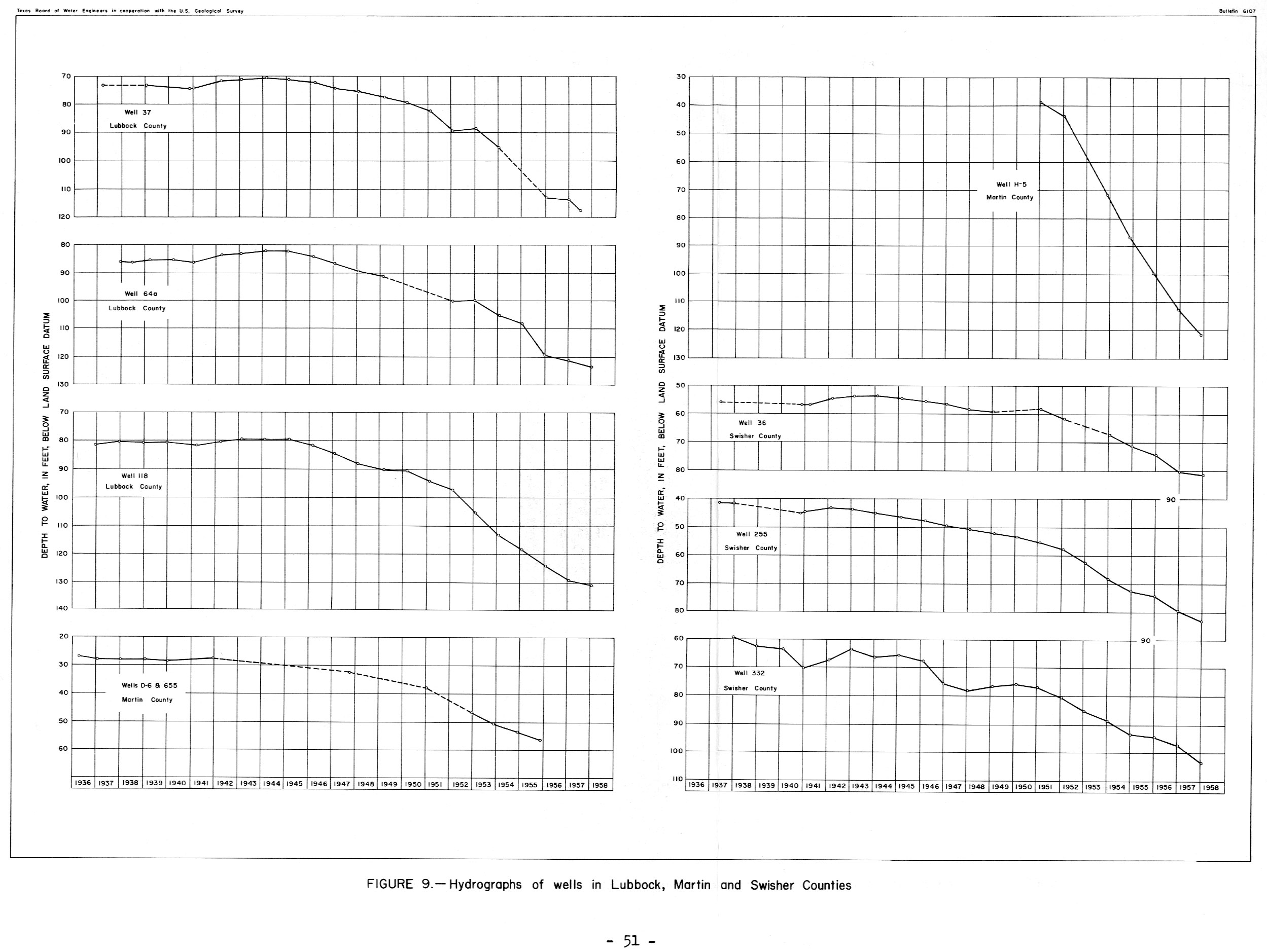
- Page 51 Figure 9 Hydrographs of wells in Lubbock, Martin and Swisher Counties
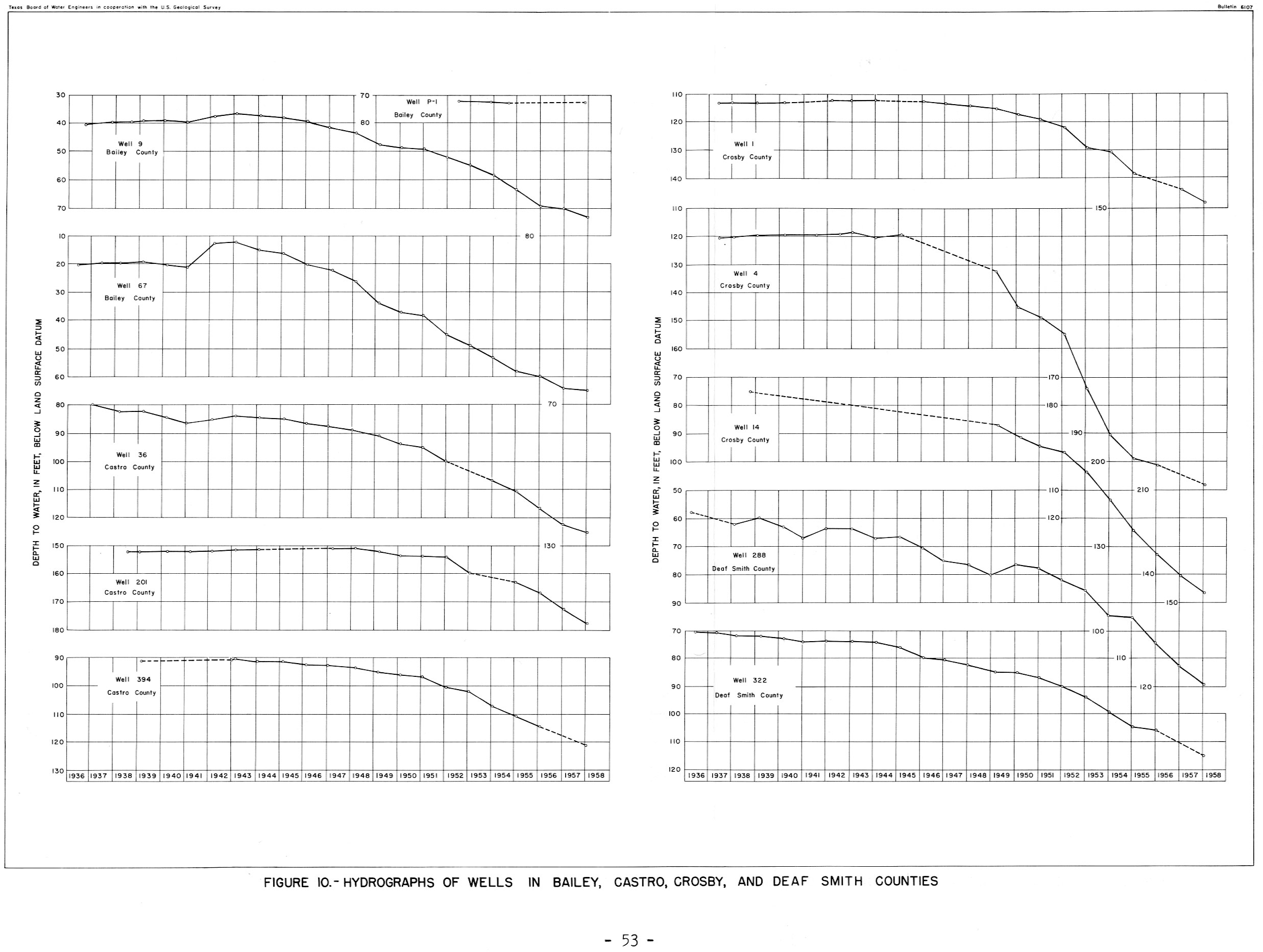
- Page 53 Figure 10 Hydrographs of wells in Bailey, Castro, Crosby, and Deaf Smith Counties
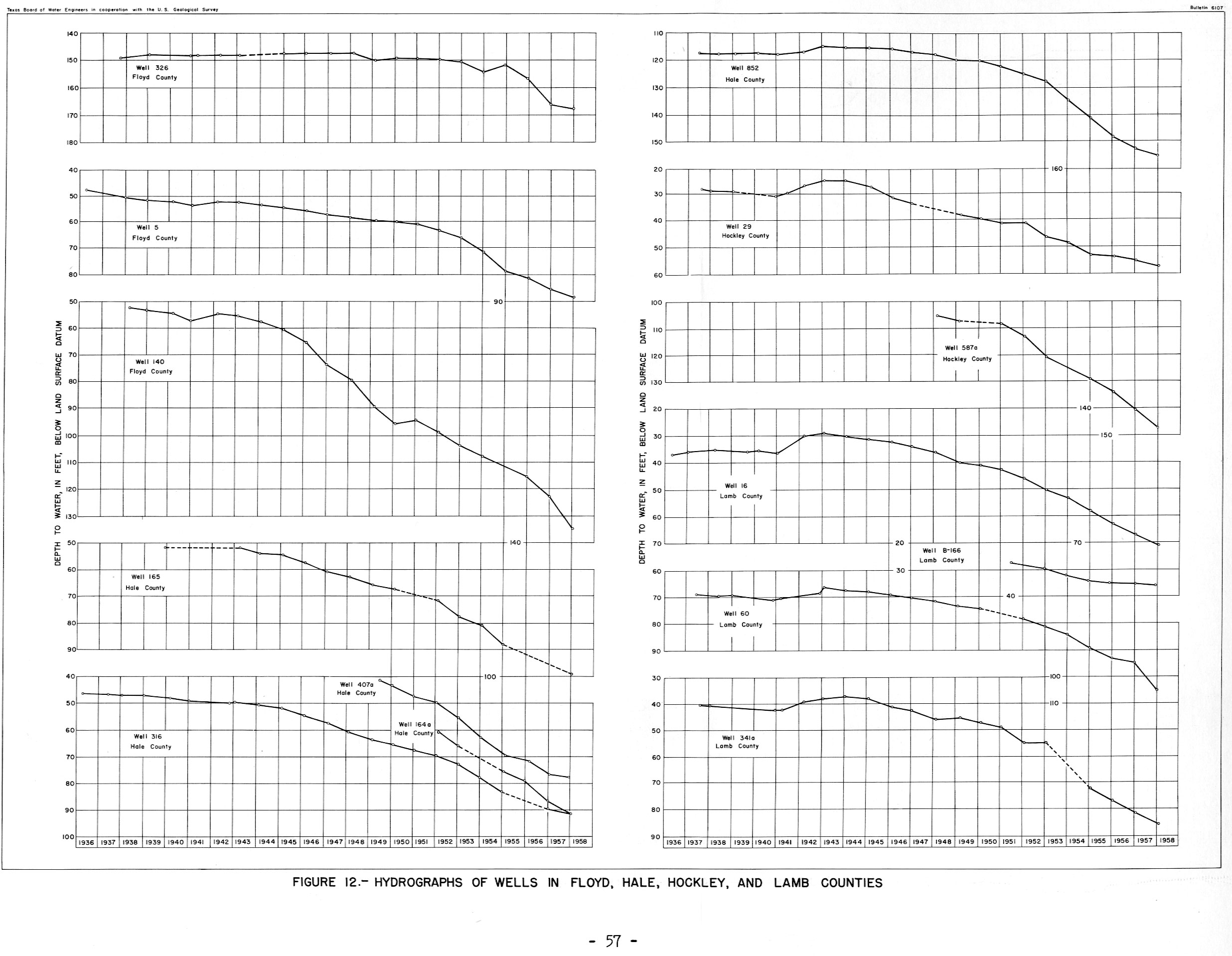
- Page 57 Figure 12 Hydrographs of wells in Floyd, Hale, Hockley, and Lamb Counties
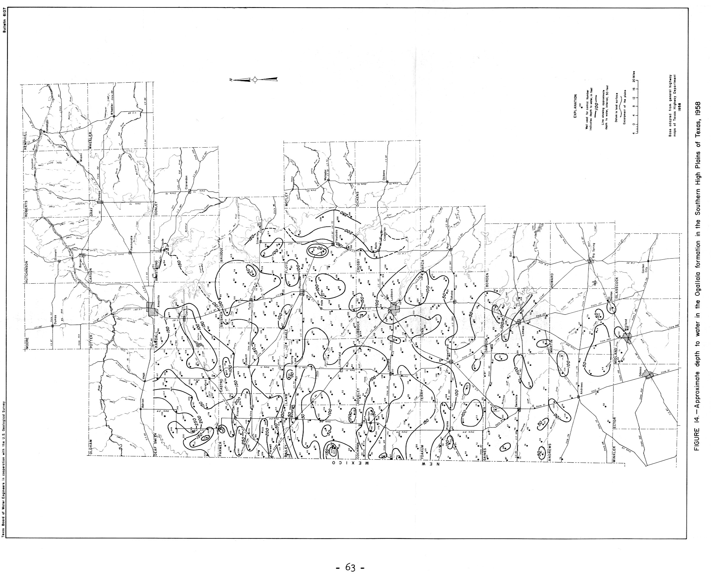
- Page 63 Figure 14 Approximate depth to and water in the Ogallala formation in the Southern High Plains of Texas, 1958
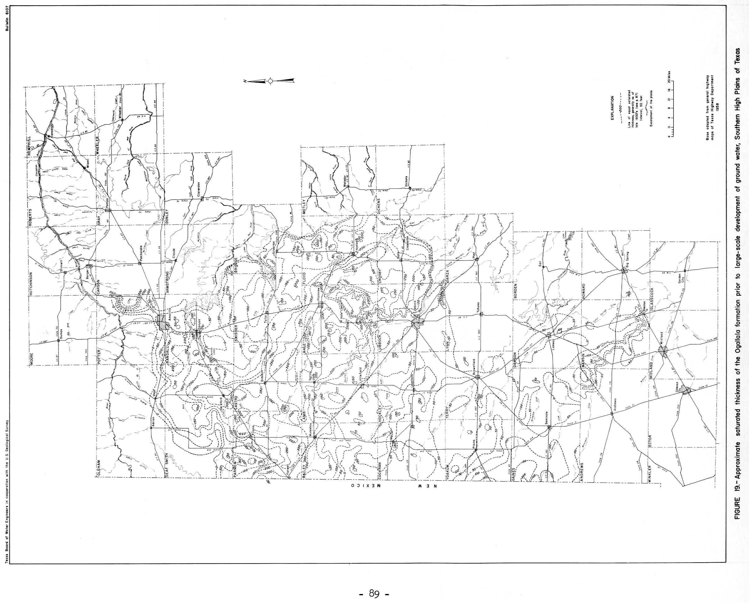
- Page 89 Figure 19 Approximate saturated thickness of the Ogallala formation prior to large-scale development of ground water, Southern High Plains of Texas