Bulletin 5709 By E.R. Leggat, U.S. Geological Survey | September 1957
Oversize fold out maps were scanned separately from the report above. "Missing pages" in the report are the maps below.
- Bulletin 5709 - Geology and Ground-Water Resources of Tarrant County, Texas
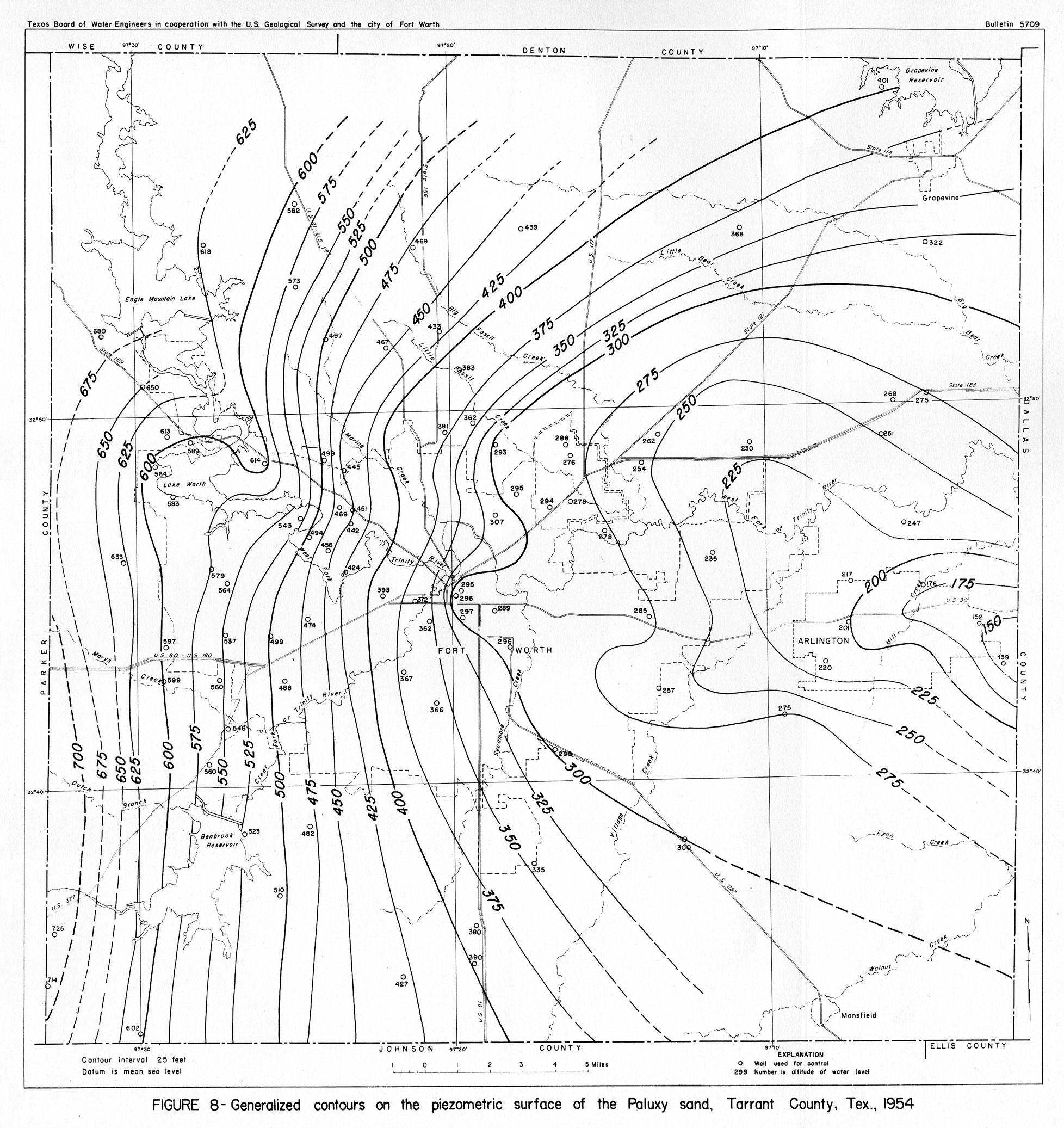
- Figure 8 - Generalized contours on the piezometric surface of the Paluxy Sand, Tarrant County, TX., 1954
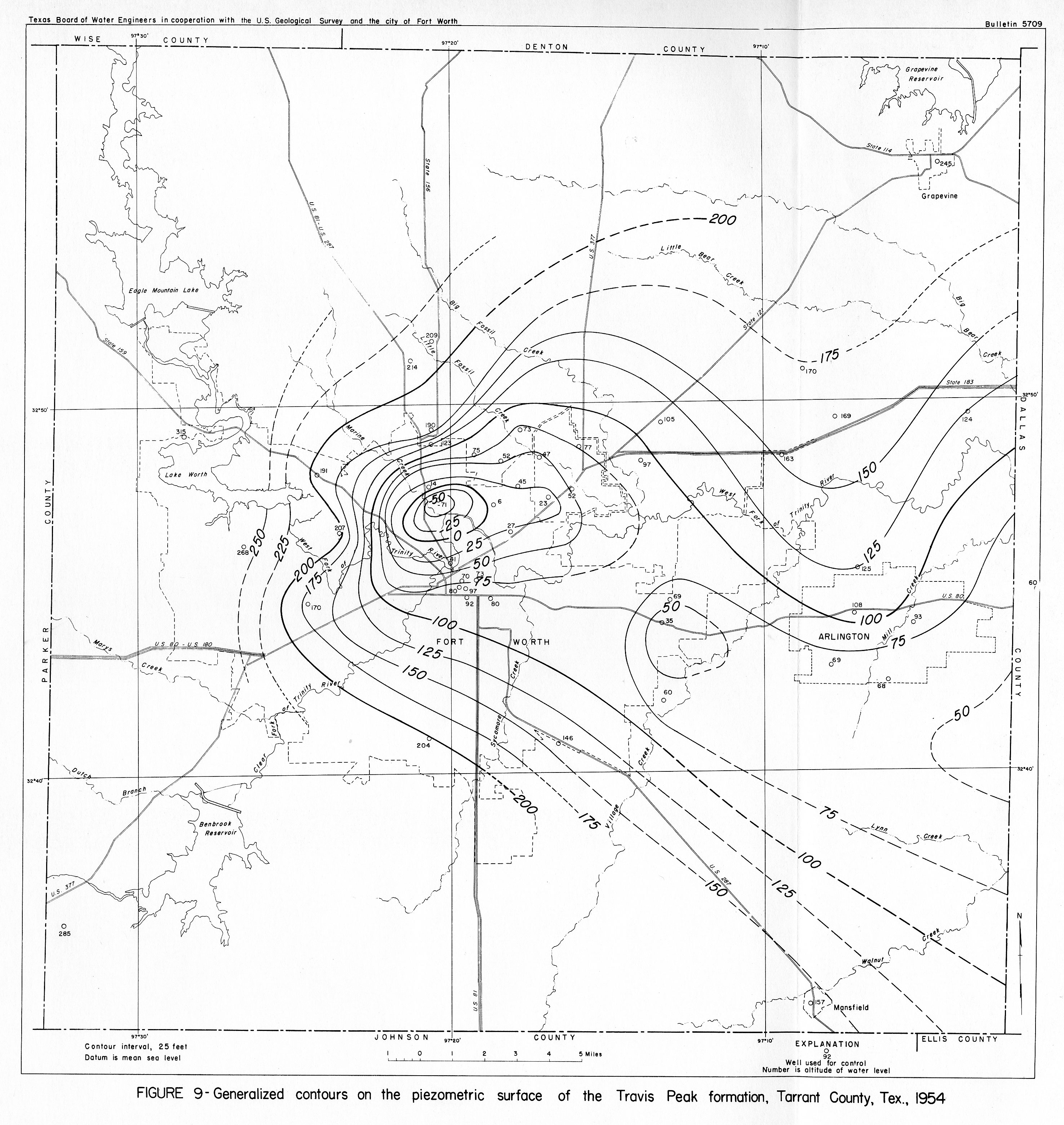
- Figure 9 - Generalized contours on the piezometric surface of the Travis Peak formation, Tarrant County, TX., 1954
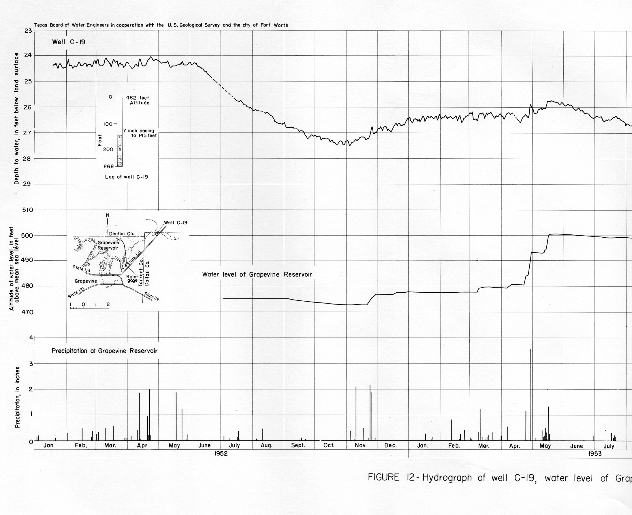
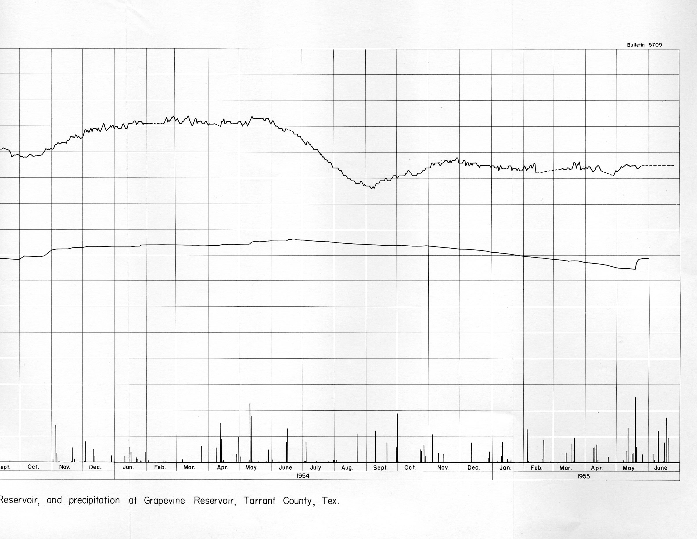
- part a | part b Figure 12 - Hydrograph of well C-19, water level of Grapevine Reservoir, and precipitation at Grapevine Reservoir, Tarrant County, Tex.
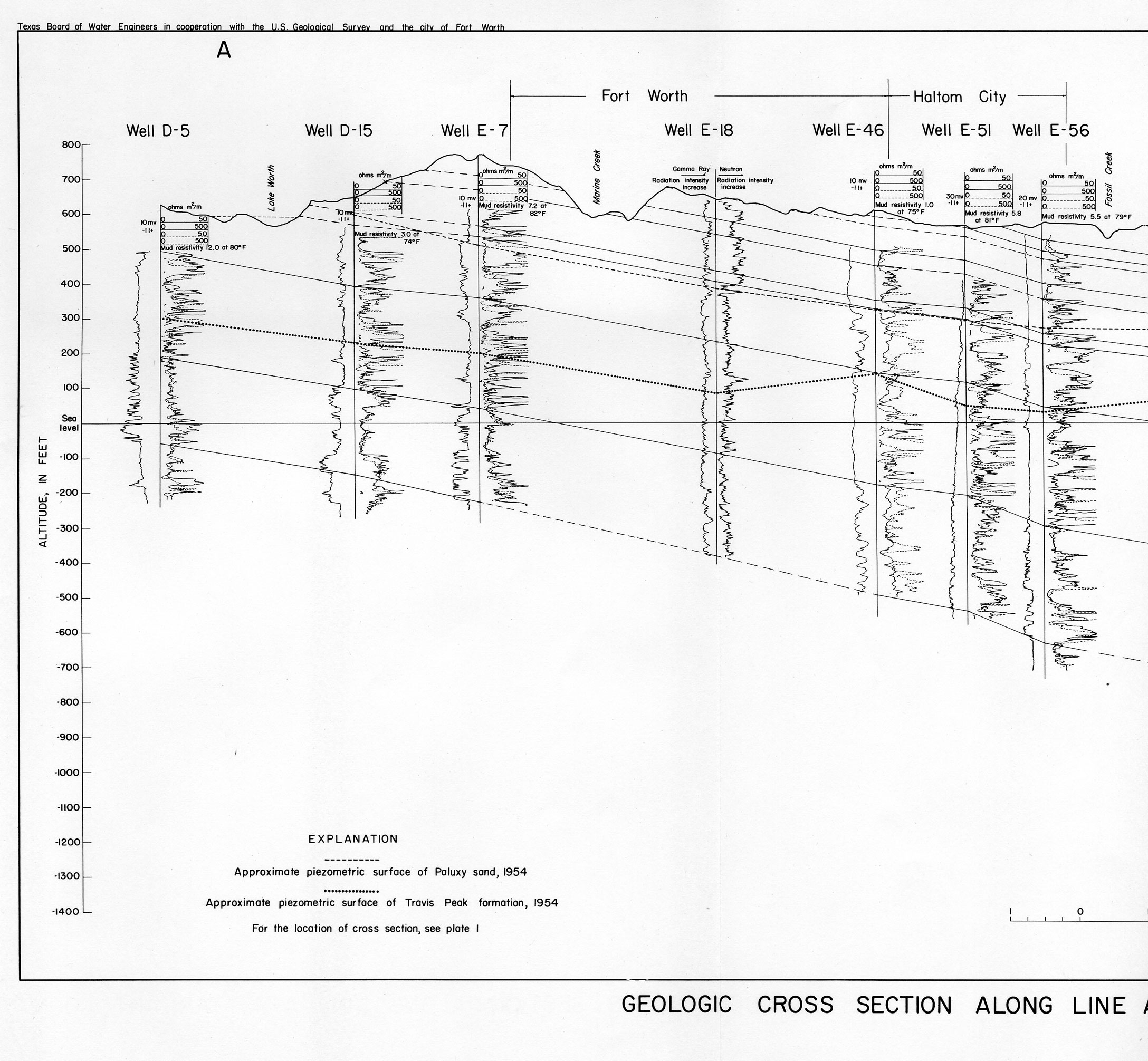
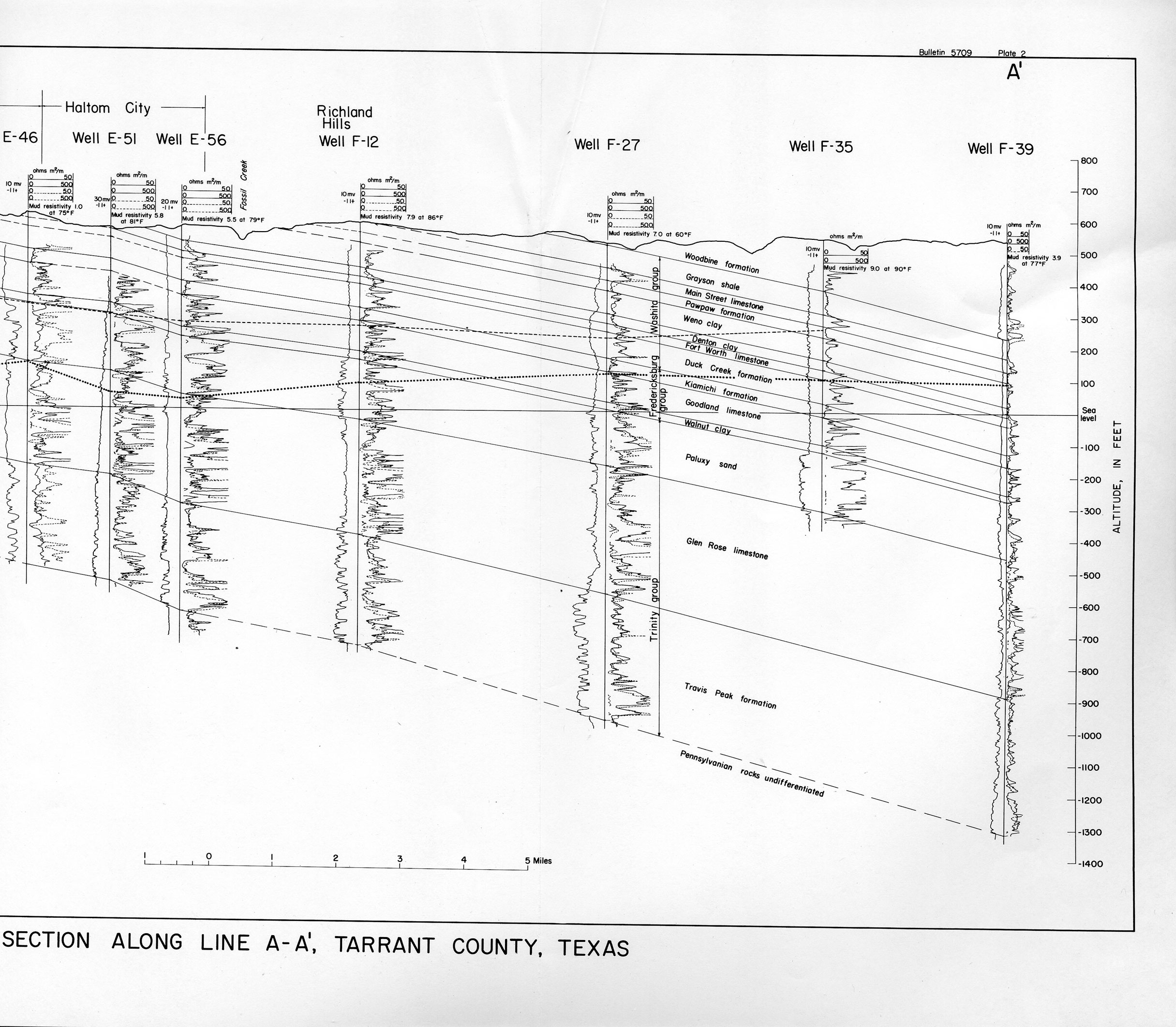
- part a | part b Geologic Cross Section along Line A-A' Tarrant County, Texas
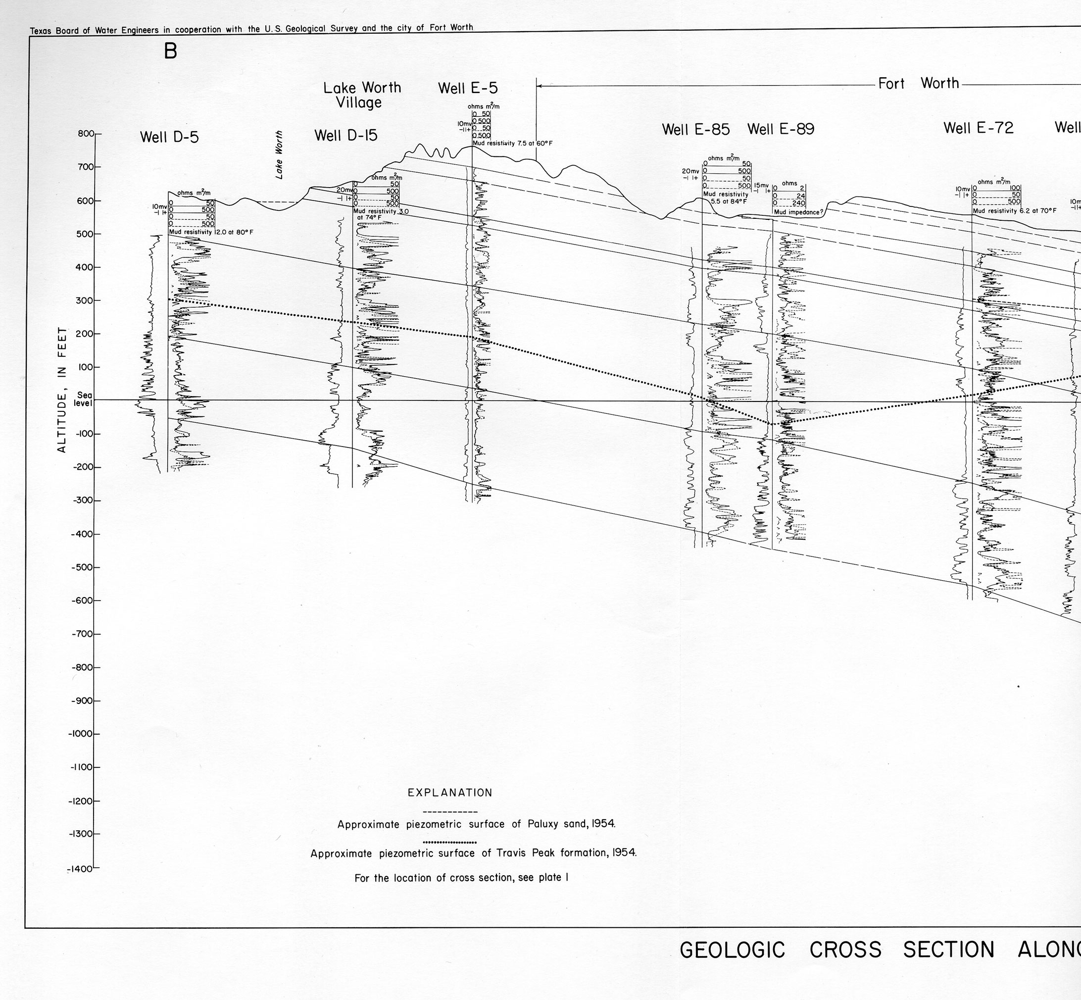
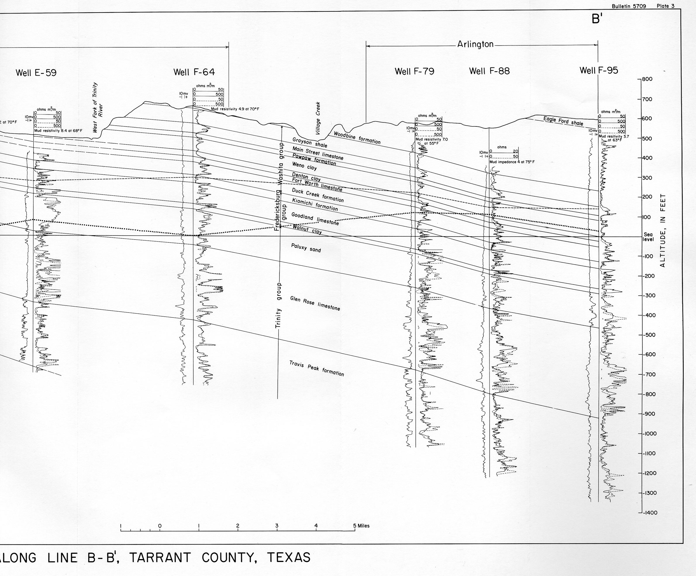
- part a | part b Geologic Cross Section along Line B-B' Tarrant County, Texas
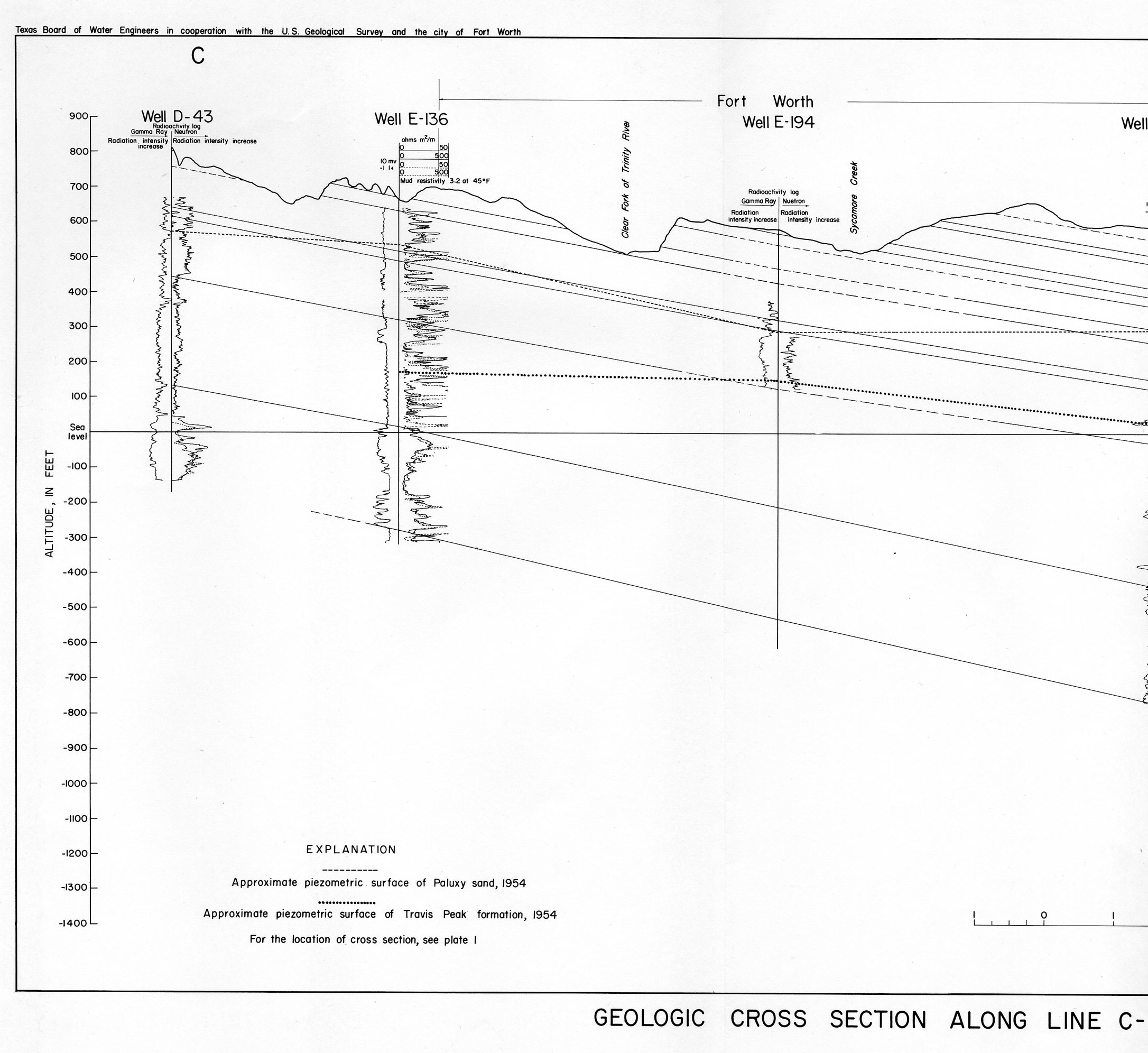
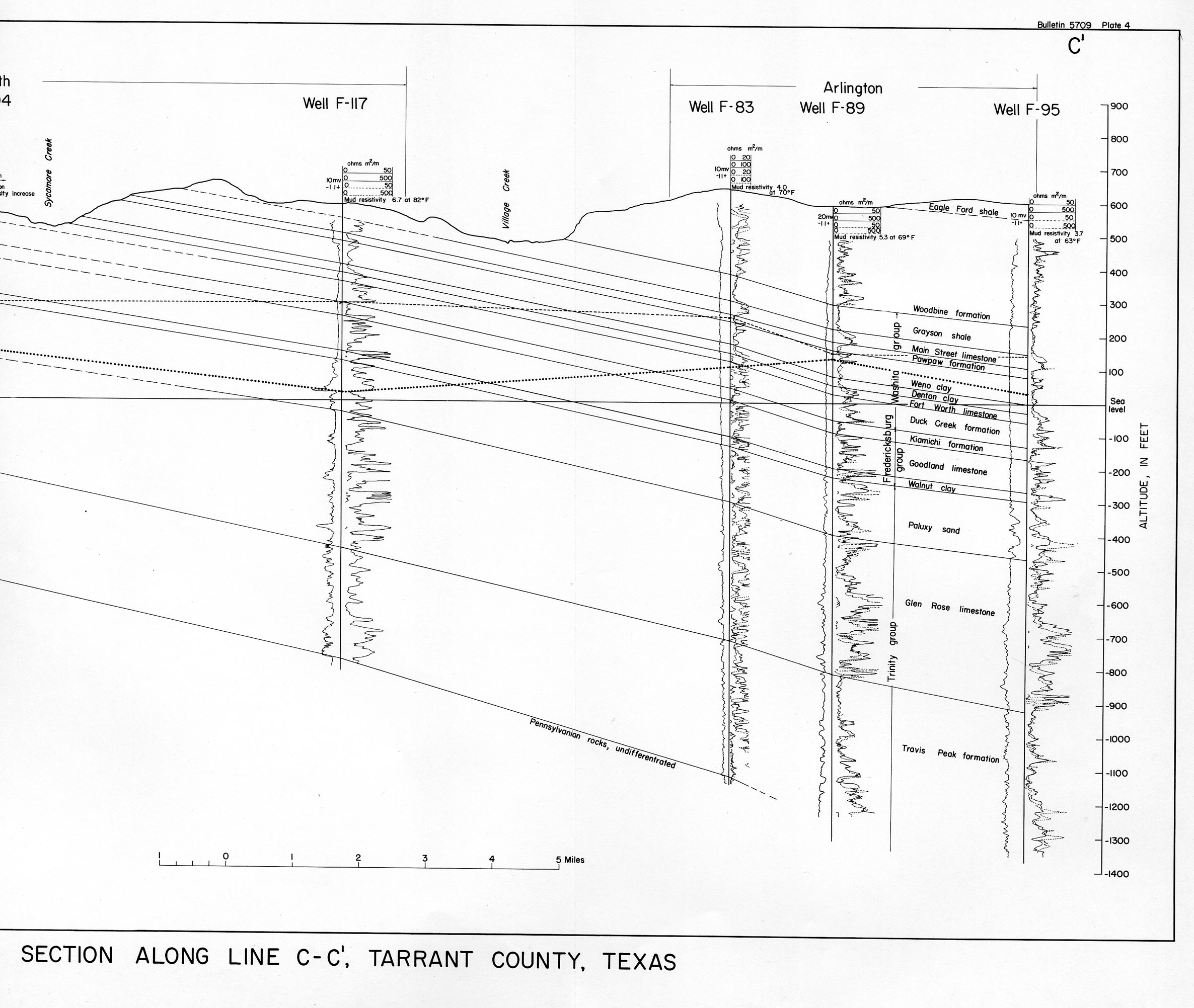
- part a | part b Geologic Cross Section along Line C-C' Tarrant County, Texas
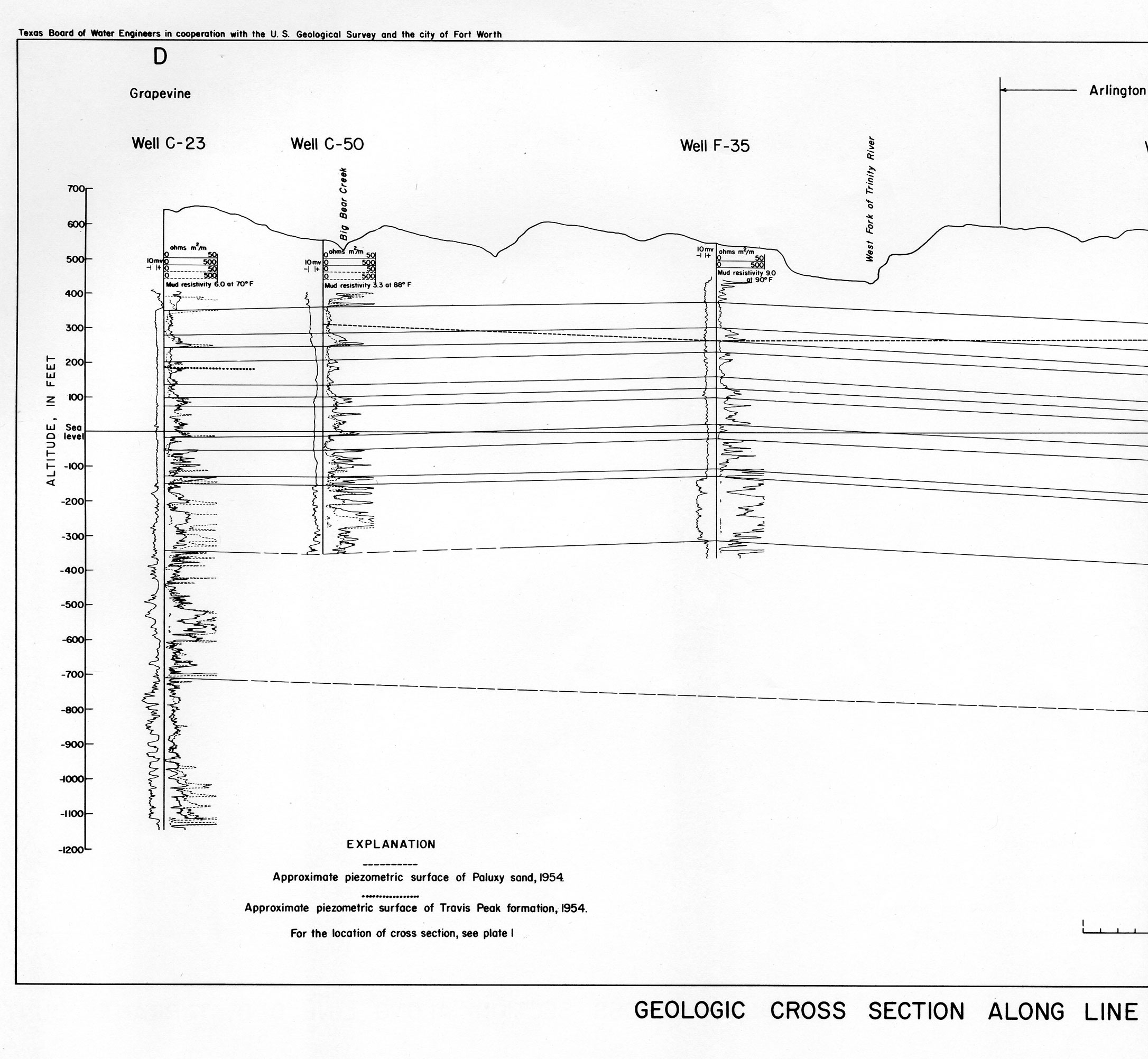
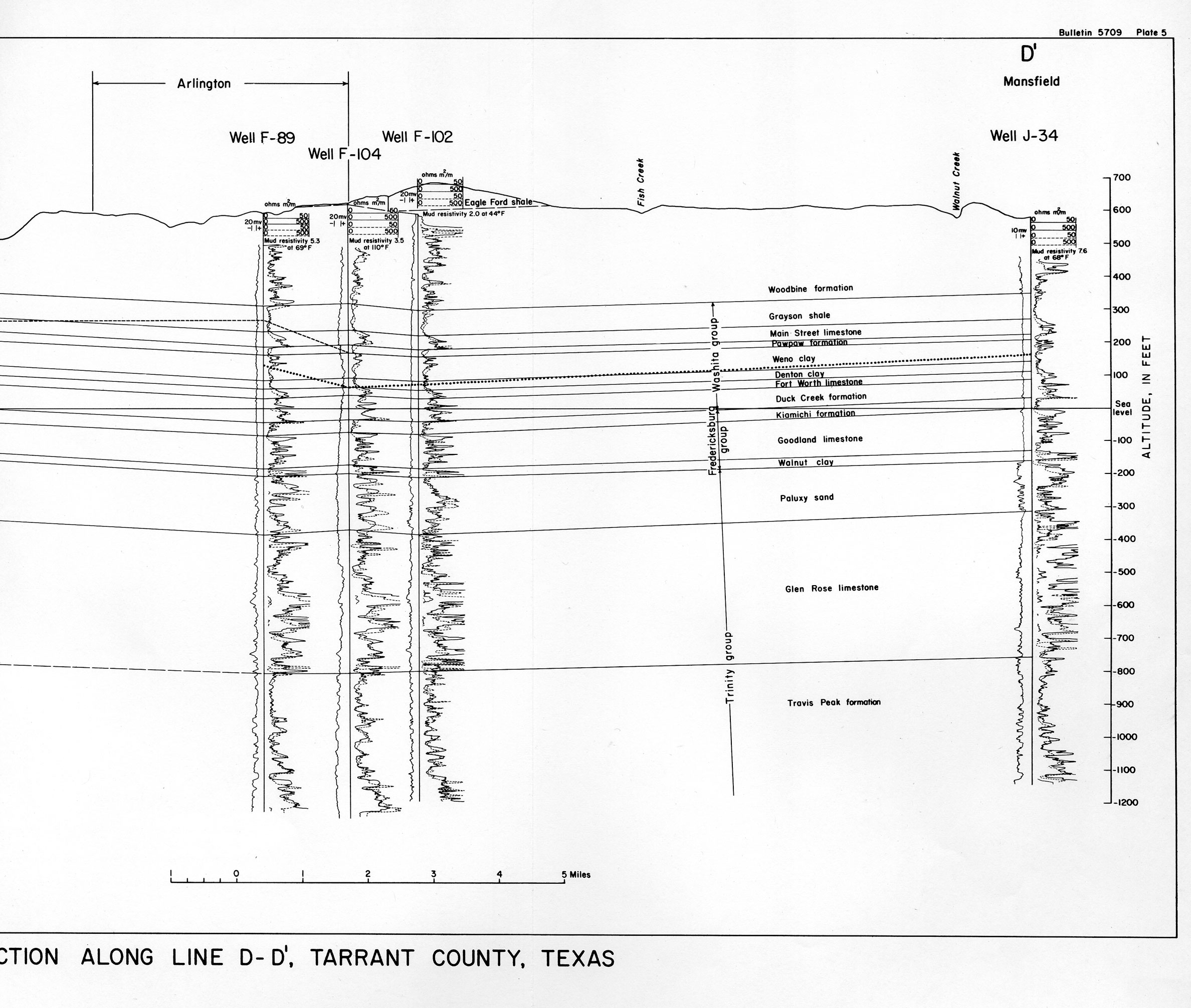
- part a | part b Geologic Cross Section along Line D-D' Tarrant County, Texas
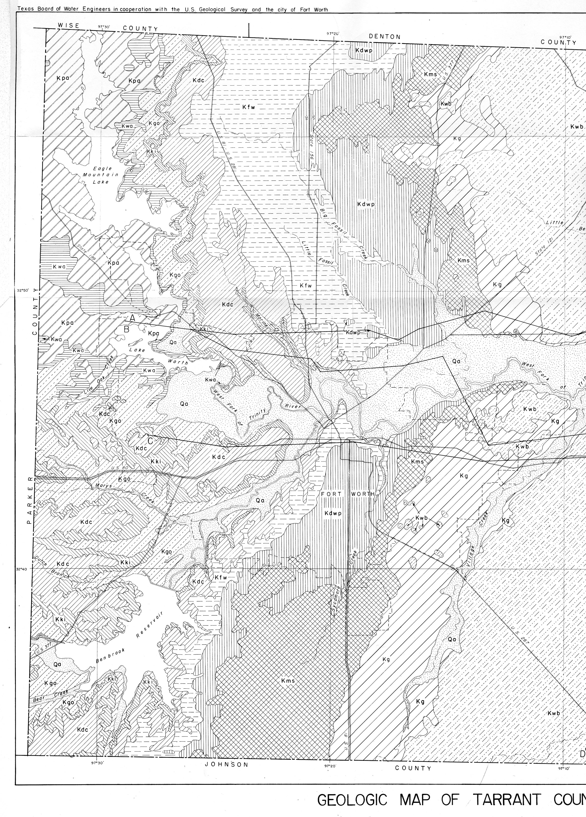
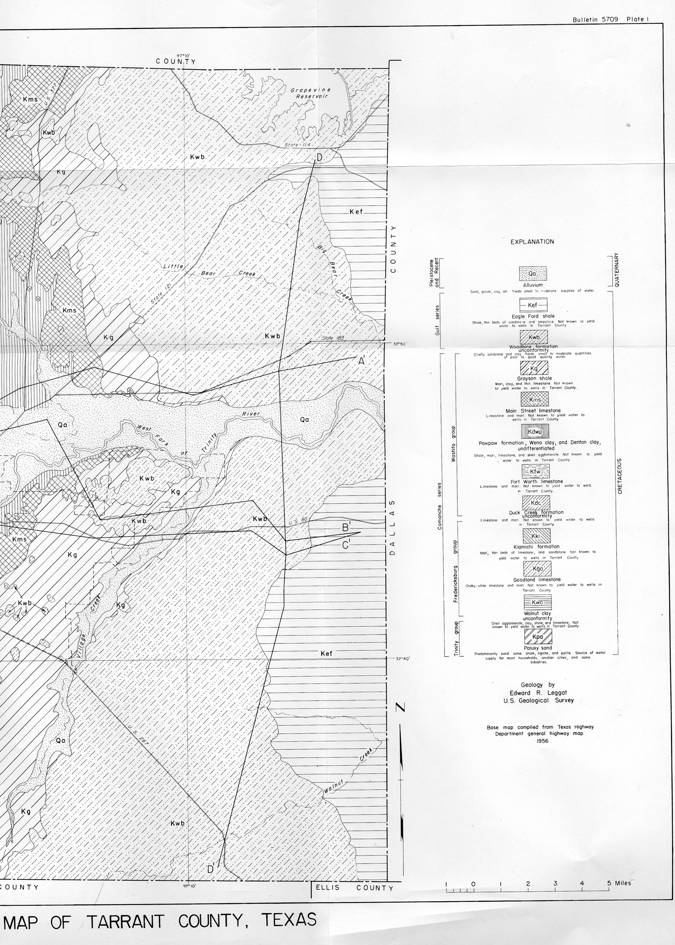
- part a | part b Geologic Map of Tarrant County, Texas
- Map of Tarrant County, Tex., showing location of wells