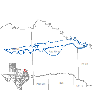
Blossom Aquifer Groundwater Availability Model (GAM)
The Texas Water Development Board has developed a groundwater availability model of the Blossom Aquifer. The final conceptual model report, the final numerical model report, and associated data are available below.
Final Conceptual Model Report
"A Conceptual Model of Groundwater Flow in the Blossom Aquifer."
Final Numerical Model Report
"Groundwater Availability Model of the Blossom Aquifer."
Model Files and Associated Data
Please see the GAM files download page for the model files and the associated data.
Stakeholder Advisory Forums (SAF)
| ID | Date | Location |
|---|---|---|
| SAF 1 | 6/25/2014 | Daingerfield, Texas - Daingerfield State Park |
| SAF 2 | 12/10/2021 | Video recording is available |
Other Resources
Please see the Blossom Aquifer and the Research Projects in Support of Groundwater Models pages for other reports and publications.