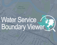
Texas Water Service Boundary Viewer
This interactive map viewer allows the public to view, search, download and print retail water service boundaries of public water systems across Texas. The viewer also provides access to related reports including historical water use data and Texas Commission on Environmental Quality public water system information.

TexMesonet
An application for viewing and accessing data from a network of selected weather stations and rain gages throughout Texas. The application includes an interactive weather map, historical weather, and data services. The interactive weather map displays current weather conditions, radar, and time series graphs.

Texas FLOOD Viewer
An interactive mapping application for viewing current conditions and up-to-date information for flooding in your area.
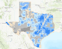
ASR or AR Statewide Suitability
StoryMap and interactive web map for the statewide survey identifying the relative suitability of Texas' major and minor aquifers for aquifer storage and recovery (ASR) or aquifer recharge (AR) projects.
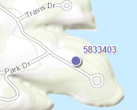
Groundwater Data Viewer
This interactive mapping application provides access to water-related data for Texas. The viewer contains several GIS datasets relating to water resources, including TWDB groundwater data, brackish groundwater data, and data from the Submitted Driller's Reports Database. For more information on TWDB groundwater data resources, please visit the following links:

2022 State Water Plan
To ensure the ongoing vitality of our economy, Texas' citizens, water experts, and government agencies collaborate in a comprehensive water planning process. We plan so that Texans will have enough water in the future to sustain our cities and rural communities, our farms and ranches, and our homes and businesses while also preserving the agricultural and natural resources that have defined Texas for generations. The 2017 State Water Plan tells us that our population will continue its rapid growth. The plan also provides a roadmap for how to address the water needs that accompany that growth by identifying water management strategies and their associated costs for communities all across the state. The information in this plan is critical to ensuring that Texas has adequate and affordable water supplies both now and in the future.
Water Data for Texas
This website is a product of the Texas Water Development Board (TWDB) Water Science Conservation Division and is made possible by the support of management and staff at TWDB. This project is part of our ongoing efforts to synthesize and communicate water-related data to scientists, policy makers and the public.

INFRM Flood Decision Support Toolbox
INFRM Flood Decision Support Toolbox shows real-time weather information and includes the estimated depth of water in hypothetical flooding scenarios. You can answer questions like "Will my house flood if a flood event causes the Colorado River to rise 10ft?"

EDAP Interactive Story Map
This interactive Story Map provides narrative and visual details about the history of the TWDB's Economically Distressed Areas Program from its inception in 1989, through present activity and looking into the future of the program.