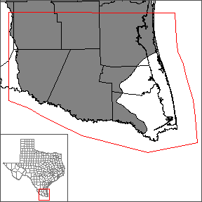
Lower Rio Grande Valley Groundwater Transport Model
In 2015 the Texas Water Development Board (TWDB) contracted with GSI Environmental, Inc., Environmental Simulations, Inc., and Errol L. Montgomery & Associates, Inc. to develop a groundwater transport model of the Lower Rio Grande Valley of Texas.
The final model reports and associated deliverables are now available. Please see below
Predictive Numerical Model Report
Predictive Numerical Model Report: Lower Rio Grande Valley Groundwater Transport Model
Numerical Model Report
Numerical Model Report: Lower Rio Grande Valley Groundwater Transport Model
Please see the GAM files download page for the model files and the source data files.
Stakeholder Advisory Forums (SAF)
Send us an email if you would like to receive SAF notifications.
| ID | Date | Location |
|---|---|---|
| SAF 1 | 11/4/2015 | Weslaco, Texas |
| SAF 2 | 7/13/2016 | Weslaco, Texas | SAF 3 | 2/8/2017 | Weslaco, Texas |
| SAF 4 | 7/12/2017 | Weslaco, Texas |
Other Resources
Please see the BRACS study of Lower Rio Grande Valley, GMA 16, Gulf Coast Aquifer System, the southern portion of the Gulf Coast Aquifer System (GAM), the GMA 16 Groundwater Flow Model, and the Research Projects in Support of Groundwater Models pages for other reports and publications.