Region 5 Neches Flood Planning Region
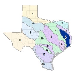 The Neches River originates in Van Zandt and Smith counties near Lake Palestine. From there, the Neches and its many tributaries continue south into the Piney woods of East Texas. There are 12 major reservoirs in this region. In the middle reaches of this basin, the Angelina River enters Sam Rayburn Reservoir, which feeds the lower Neches as it crosses through the Angelina National Forest and the Big Thicket National Preserve. After skirting northeast around Beaumont, the Neches merges with the Sabine River at Port Arthur on Sabine Lake and enters the Gulf of Mexico through Texas Point National Wildlife Refuge.
For a detailed map of Region 5, please visit the Texas Geographic Information Office (TxGIO) Flood Planning Regions Map Collection.
Go to Region 5 Neches RFPG External Host Website
Population Estimate (2019): 918,370
Approximate Area: 11,452 square miles
Approximate Stream Miles: 9,673
Approximate NFIP Claims (1975-2019): $1,908,581,588
Counties Represented:
- Anderson*
- Angelina
- Chambers*
- Cherokee
- Galveston*
- Hardin*
- Harris*
- Henderson*
- Houston*
- Jasper
- Jefferson
- Liberty*
- Nacogdoches
- Newton*
- Orange*
- Polk*
- Rusk*
- Sabine
- San Augustine*
- Shelby*
- Smith*
- Trinity*
- Tyler
- Van Zandt*
*indicates this county is partially within this RFPG and is also represented by at least one other RFPG
Major Cities (Population greater than 25,000):
- Beaumont
- Lufkin
- Nacogdoches
- Port Arthur
- Tyler*
*indicates this city is partially within this RFPG and is also represented by at least one other RFPG
Major Lakes & Reservoirs:
- B.A. Steinhagen Lake
- J.D. Murphree Wildlife Impoundment
- Lake Athens
- Lake Jacksonville
- Lake Kurth
- Lake Nacogdoches
- Lake Naconiche
- Lake Palestine
- Lake Striker
- Lake Tyler
- Pinkston Reservoir
- Sam Rayburn Reservoir
Ecoregions of Texas Represented:
- Blackland Prairie
- Gulf Prairies
- Piney Woods
- Post Oak Savanah
Regional Flood Planning Group Meeting Minutes & Updates
Please see the RFPG Meeting Schedule webpage for information on the past and upcoming meetings.
Contacts
Planning Group Sponsor Contact: Lower Neches Valley Authority, Risa Barber, (409) 892-4011
Planning Group Chair: Steve Moon, (409) 720-9715
TWDB Contact:Katie Koslan, (512) 475-1091