Region 15 Lower Rio Grande Flood Planning Region
 This region begins at International Amistad Reservoir in Val Verde County, which separates the Upper and Lower Rio Grande regions, and extends to the Rio Grande Valley region near the Gulf of Mexico. It contains six major lakes/reservoirs, including two that border the U.S. and Mexico.
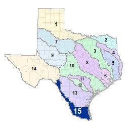
For a detailed map of Region 15, please visit the Texas Geographic Information Office (TxGIO) Flood Planning Regions Map Collection.
Go to Region 15 Lower Rio Grande RFPG External Host Website
Population Estimate (2019): 1,776,732
Approximate Area: 12,418.81 square miles
Approximate Stream Miles: 5,300
Approximate NFIP Claims (1975-2019): $173,104,689
Counties Represented:
- Brooks*
- Cameron
- Dimmit*
- Edwards*
- Hidalgo
- Jim Hogg*
- Kenedy*
- Kinney*
- Maverick*
- Starr
- Val Verde
- Webb*
- Willacy
- Zapata
*indicates this county is partially within this RFPG and is also represented by at least one other RFPG
Major Cities (Population greater than 25,000):
- Brownsville
- Del Rio
- Eagle Pass
- Edinburg
- Harlingen
- Laredo
- McAllen
- Mission
- Pharr
- San Juan
- Weslaco
Major Lakes & Reservoirs:
- Anzalduas Channel Dam
- Casa Blanca Lake
- Delta Lake
- International Amistad Reservoir
- International Falcon Reservoir
- Loma Alta Lake
- Valley Acres Reservoir
Ecoregions of Texas Represented:
- Edwards Plateau
- Gulf Prairies
- South Texas Plains
Regional Flood Planning Group Meeting Minutes & Updates
Please see the RFPG Meeting Schedule webpage for information on the past and upcoming meetings.
Contacts
Planning Group Sponsor Contact: Hidalgo County Drainage District No. 1, Jaime Salazar, (956) 292-7080
Planning Group Chair: David Garza, (956) 361-8209
TWDB Contact: Nick Collins, (512) 475-1705