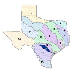
Region 12 San Antonio Flood Planning Region
 The Medina river originates in Northwestern Bandera county on the Edwards Plateau where it flows southeast to merge with the San Antonio River, flowing from its spring-fed headwaters in Bexar County, just southeast of the City of San Antonio. From there, the San Antonio River flows across the South Texas Plains largely unimpeded where it empties into the Guadalupe River just northwest of San Antonio Bay. Other streams within the basin include the Leon, Salado, Calaveras, and Cibolo creeks. This region crosses five ecoregions and is home to three major lakes and reservoirs.
For a detailed map of Region 12, please visit the Texas Geographic Information Office (TxGIO) Flood Planning Regions Map Collection.
Go to Region 12 San Antonio RFPG External Host Website
Population Estimate (2019): 2,225,430
Approximate Area: 4,422 square miles
Approximate Stream Miles: 4,206
Approximate NFIP Claims (1975-2019): $48,925,054
Counties Represented:
- Aransas*
- Atascosa*
- Bandera*
- Bexar*
- Calhoun*
- Comal*
- De Witt*
- Goliad*
- Guadalupe*
- Karnes*
- Kendall*
- Kerr*
- Medina*
- Refugio*
- Victoria*
- Wilson*
*indicates this county is partially within this RFPG and is also represented by at least one other RFPG
Major Cities (Population greater than 25,000):
- Cibolo*
- Converse
- New Braunfels*
- San Antonio
- Schertz*
- Timberwood Park
*indicates this city is partially within this RFPG and is also represented by at least one other RFPG
Major Lakes & Reservoirs:
- Calaveras Lake
- Medina Lake
- Victor Braunig Lake
Ecoregions of Texas Represented:
- Blackland Prairie
- Edwards Plateau
- Gulf Prairies
- Post Oak Savanah
- South Texas Plains
Regional Flood Planning Group Meeting Minutes & Updates
Please see the RFPG Meeting Schedule webpage for information on the past and upcoming meetings.
Contacts
Planning Group Sponsor Contact: San Antonio River Authority, Kendall Hayes, (210) 302-3641
Planning Group Chair: Derek Boese, (210) 227-1373
TWDB Contact:Tressa Olsen, CFM, (512) 475-1908