Report 12 by C.R. Follett, U.S. Geological Survey | September 1975
- Report 12 - Ground-Water Resources of Caldwell County, Texas (pdf - 11.0MB)
- Figure 3 - Map Showing Location of Soil Conservation Service Reservoir Sites in Plum Creek Watershed
- Figure 6 - Geologic Map
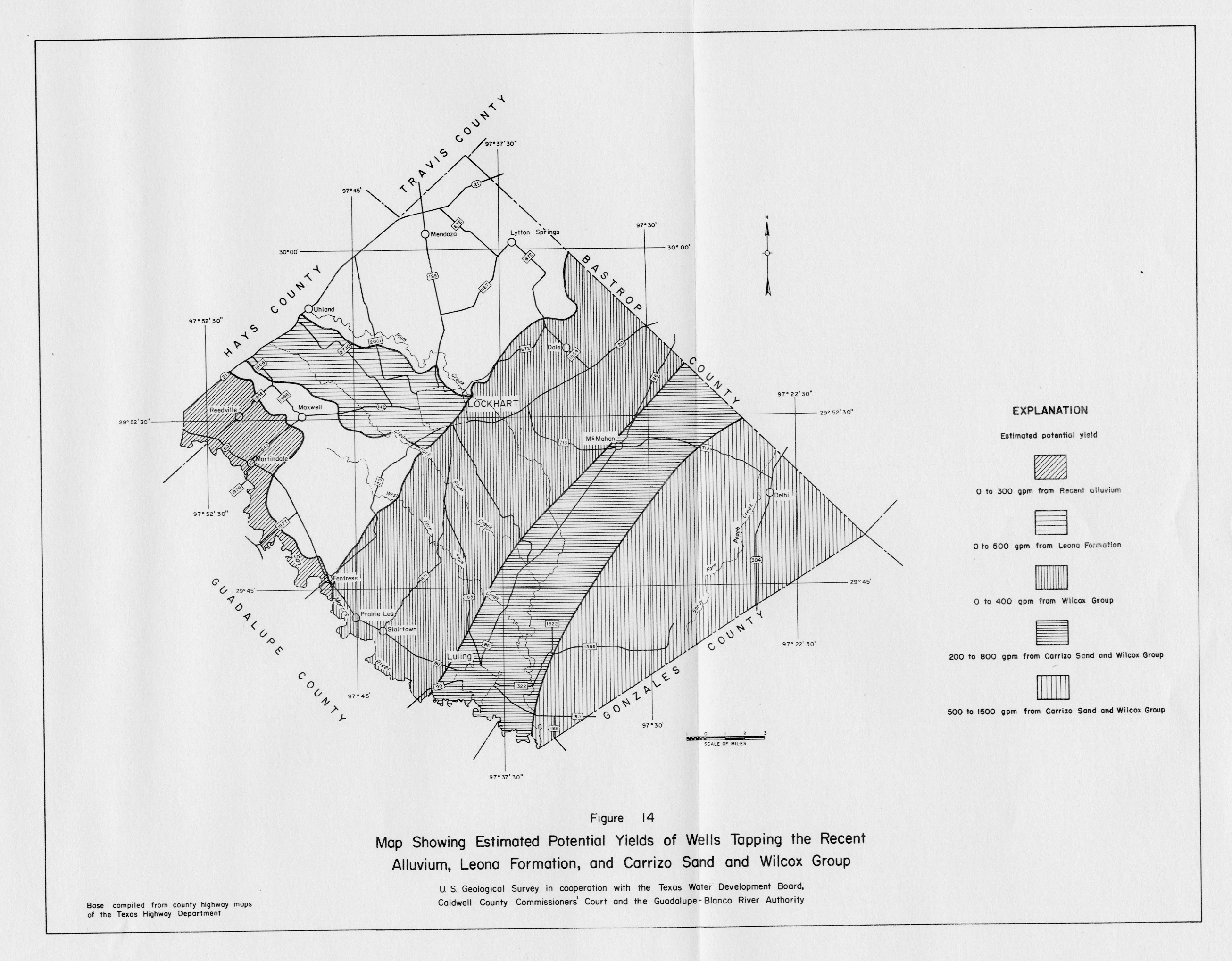
- Figure 14 - Map Showing Estimated Potential Yields of Wells Tapping the Recent Alluvium, Leona Formation, and Carrizo Sand and Wilcox Group
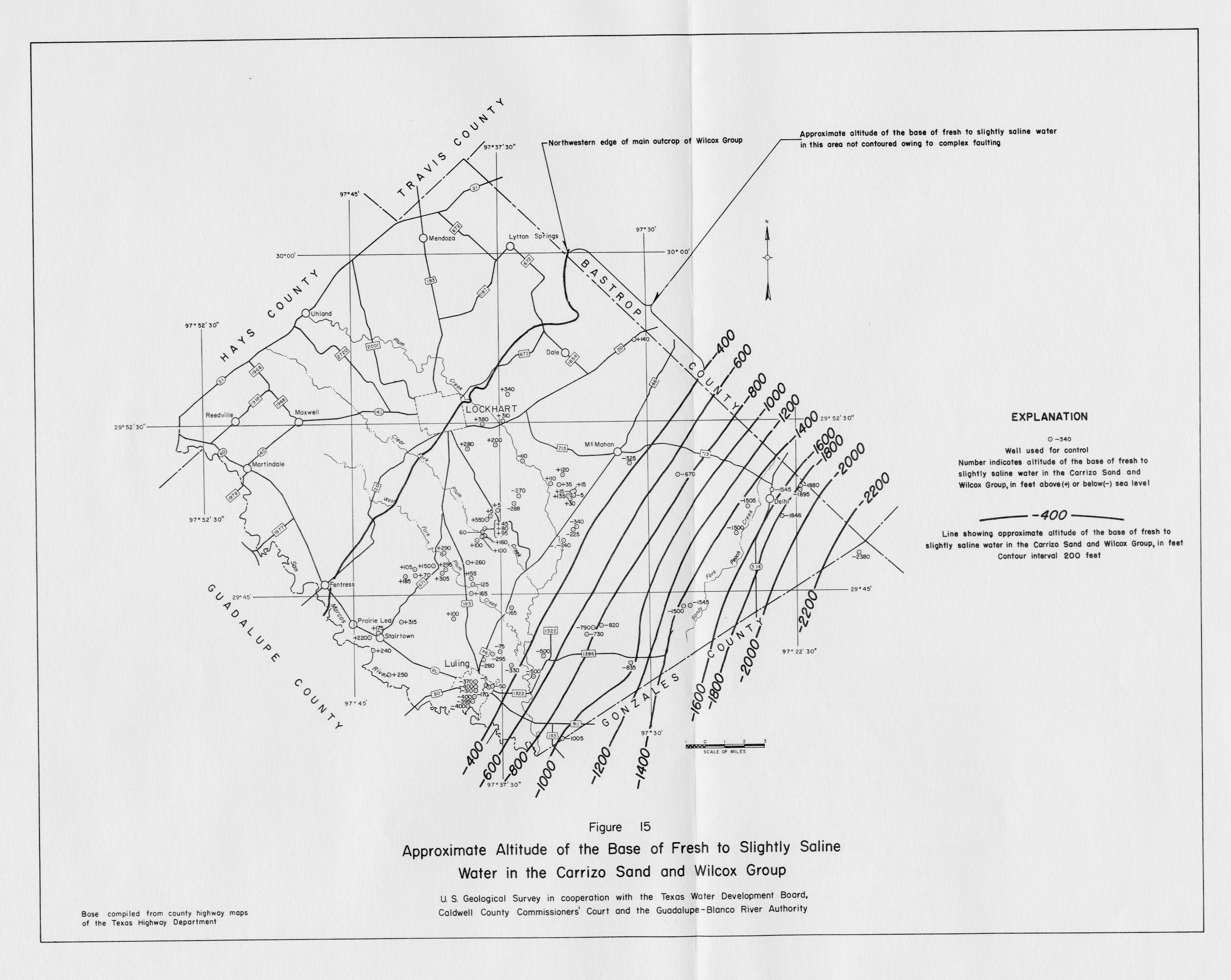
- Figure 15 - Approximate Altitude of the Base of Fresh to Slightly Saline Water in the Carrizo Sand and Wilcox Group
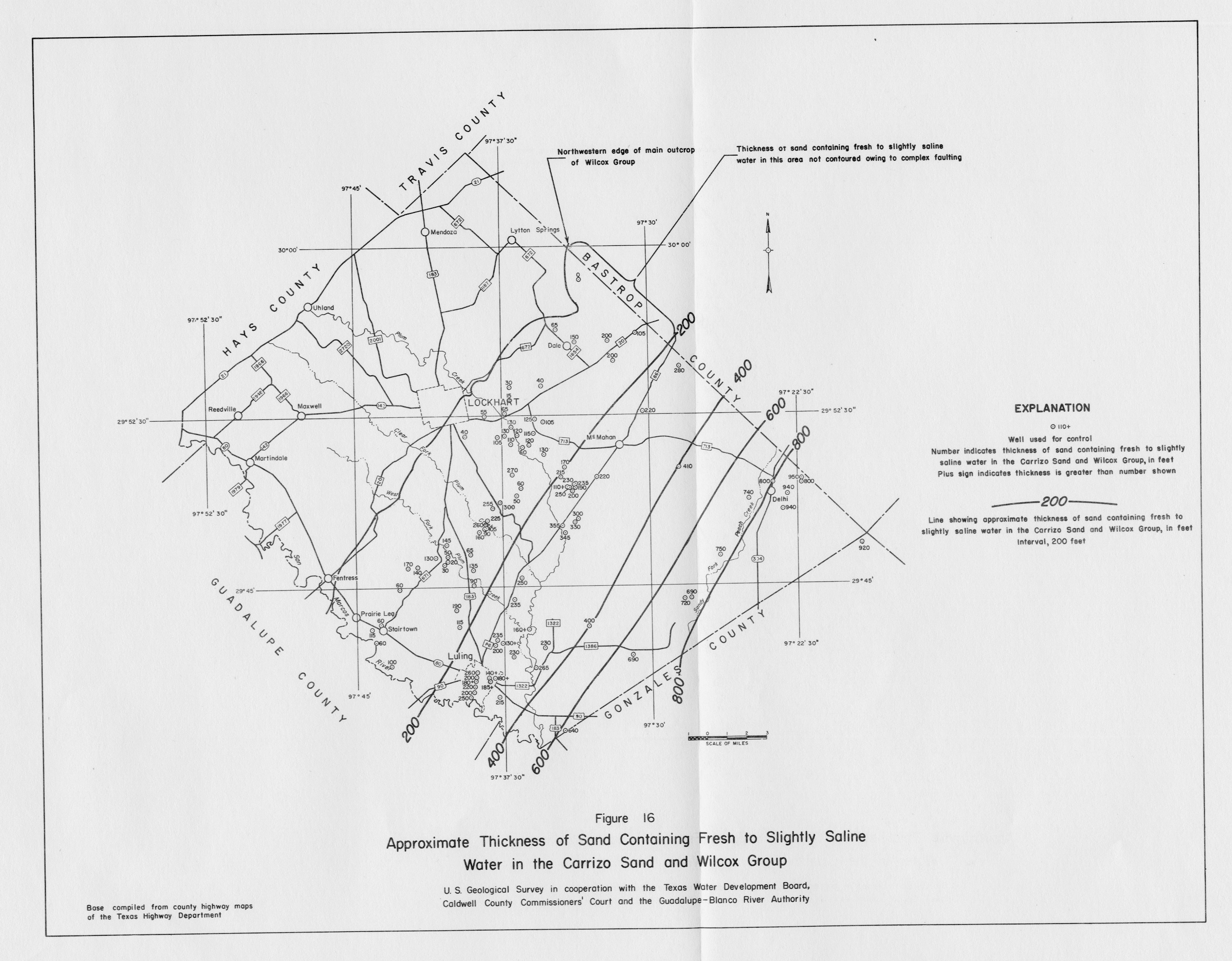
- Figure 16 - Approximate Thickness of Sand Containing Fresh to Slightly Saline Water in the Carrizo Sand and Wilcox Group
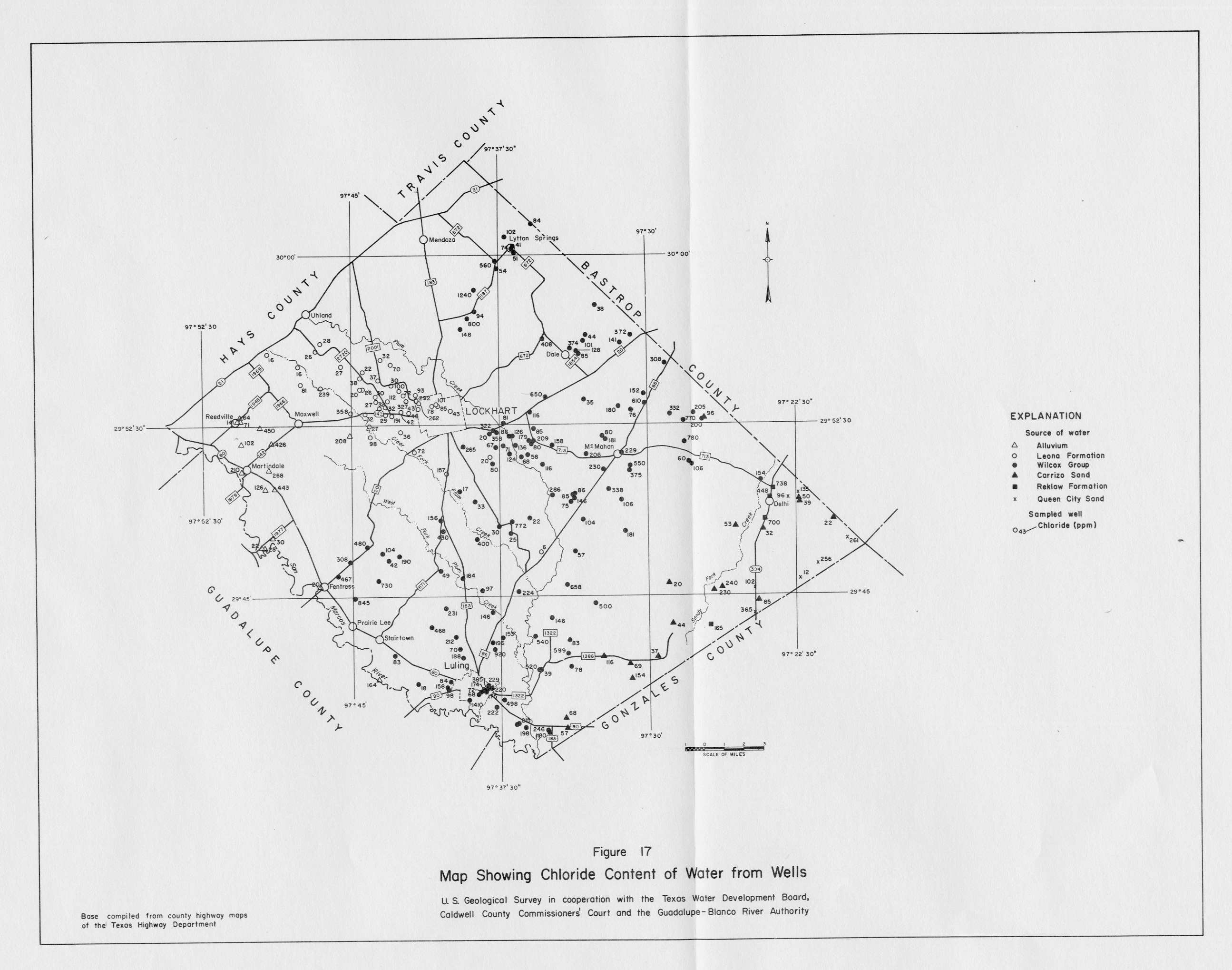
- Figure 17 - Map Showing Chloride Content of Water from Wells
- Plate 1 (pdf - 4.79MB) - Map Showing Locations of Wells and Springs in Caldwell County
- Plate 2 (pdf - 4.80MB) - Geologic Section A-A'
- Plate 3 (pdf - 4.65MB) - Geologic Section B-B'