Surveying Methods & Technology
Reservoir Boundary
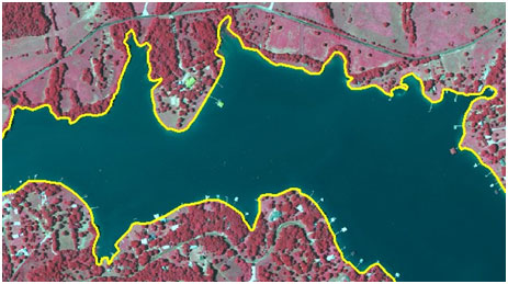
One of the initial steps in preparing for a hydrographic survey is to establish a reservoir boundary. Boundaries are digitized from digital orthophoto quarter quadrangle (DOQQ) images (aerial photographs) available from the Texas Geographic Information Office (TxGIO).
Planned Survey Lines
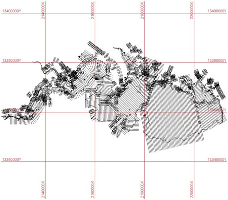
Each survey occurs along pre-planned range lines oriented perpendicular to the assumed location of the original river channels and spaced approximately 500 feet apart.
Sediment Core Sampling
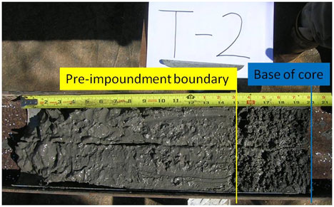
The pre-impoundment surface is identified in the sediment core sample by: (1) a visual examination of the core for in-place terrestrial materials, such as leaf litter, tree bark, twigs, intact roots, etc., (2) changes is structure and texture from well sorted, relatively fine grained sediment to poorly sorted mixtures of coarse and fine-grained materials, and/or (3) variations in the physical properties of the sediment, particularly water content.
Spatial Interpolation of Reservoir Bathymetry
To improve the accuracy of the representation of the bathymetry between survey lines, the TWDB has developed various anisotropic spatial interpolation techniques. A basic assumption is that the reservoir profile in the vicinity of a particular location has upstream and downstream similarity.
Multi-Frequency Depth Sounder
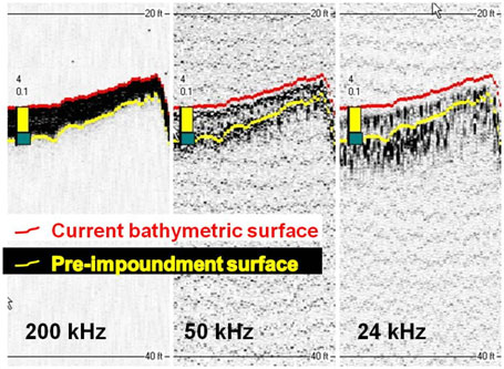
The TWDB uses a multi-frequency depth sounder integrated with a differential global positioning system (DGPS) for sedimentation surveys. The acoustic profiles are analyzed for the current and pre-impoundment surfaces with the aid of sediment core samples.
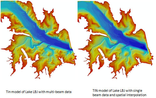
Multi-Beam Depth Sounder
Multi-beam data reduces and could eliminate the need for interpolation of the reservoir bathymetry.
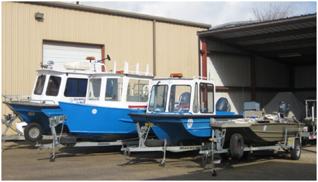
Survey Vessels
The TWDB uses multiple survey vessels depending on the lake's physical characteristics and conditions.