Lake Abilene (Brazos River Basin)
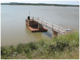 Lake Abilene (also known as Abilene Reservoir or Abilene Dam) is located about six miles northwest of Tuscola in Taylor County, on Elm Creek, a tributary of Clear Fork Brazos River, which is a tributary of the Brazos River. It is owned and operated by the City of Abilene for recreational and emergent water supply purposes. Water Right Permit No. 253 (Application No. 259) authorized the dam and impoundment on September 7, 1918. Construction of the dam started in 1919 and was completed in 1921. Extensive repairs were done in 1941 and 1957. Abilene Dam is an earthfill embankment with a homogeneous earth core structure. Its maximum height is 64 feet with a length of 5,040 feet. The top of the dam is at an elevation of 2,024 feet above mean sea level. The uncontrolled concrete-paved emergency spillway is located near the left bank, with a crest length of 2,000 feet at an elevation of 2,018 feet above mean sea level. The lake has a storage capacity of 7,900 acre feet, encompassing a surface area of 595 acres at the top of the conservation pool, at an elevation of 2,012.3 feet above mean sea level. It drains an area of 110 square miles above the dam site.